


Distance Calculator


A3, A1
1919.9 km, 20 h 4 min
| Head east | 55 m | |
| Turn left | 25 m | |
| Turn right onto Recheisstraße | 150 m | |
| Turn right onto Speckbacherstraße | 200 m | |
| Enter the traffic circle and take the 2nd exit onto Stadtgraben (L8) | 20 m | |
| Exit the traffic circle onto Stadtgraben (L8) | 150 m | |
| Continue onto B171a | 500 m | |
| Turn left onto B171a | 450 m | |
| Take the ramp on the left towards A12 | 150 m | |
| Merge left towards Wattens | 70 km | |
| Continue onto Inntalautobahn (A 93) | 25 km | |
| Keep right towards A 8: Salzburg | 700 m | |
| Merge left towards A 8: Wien | 70 km | |
| Continue onto West Autobahn (A1) | 2 km | |
| Take exit 298 towards A10: Salzburg-Süd | 1.5 km | |
| Continue onto Tauern Autobahn (A10) | 25 km | |
| Continue onto Ofenauer Tunnel (A10) | 1.5 km | |
| Continue onto Salzachbrücke Paß Lueg (A10) | 150 m | |
| Continue onto Hiefler Tunnel (A10) | 2 km | |
| Continue onto Tauern Autobahn (A10) | 150 km | |
| Continue towards A11 | 15 km | |
| Take the ramp | 600 m | |
| Merge left onto Karawanken Autobahn (A11) | 900 m | |
| Continue onto Talübergang Gratschützenbach (A11) | 150 m | |
| Continue onto Karawankentunnel (A11) | 4.5 km | |
| Continue onto Predor Karavanke (A2) | 70 km | |
| Keep left towards A1: Gradec | 900 m | |
| Continue towards Gradec | 250 m | |
| Continue onto Dolgi most (A1) | 300 m | |
| Continue onto Južna obvoznica (A1) | 8 km | |
| Keep right towards A2: Zagreb | 100 km | |
| Continue onto A3 | 300 km | |
| Take the ramp | 550 m | |
| Merge left onto A3 | 300 m | |
| Turn right | 80 m | |
| Turn left | 70 m | |
| Take the ramp on the right | 450 m | |
| Merge left onto A3 | 90 km | |
| Keep left towards A 1: Sofia(BG) | 2.5 km | |
| Merge right onto Обилазница око Београда (A1) | 30 km | |
| Keep left towards A 1: Skopje | 200 km | |
| Take the ramp towards A4: Sofia (BG) | 1.5 km | |
| Continue onto A4 | 100 km | |
| Continue onto Автомагистрала Европа (A 6) | 35 km | |
| Keep left towards 8 | 15 km | |
| Enter the traffic circle and take the 3rd exit towards Видин | 150 m | |
| Exit the traffic circle towards Видин | 350 m | |
| Take the ramp on the left towards Видин | 100 m | |
| Merge left onto Околовръстен път (8) | 4 km | |
| Take exit 49 towards А 6: Варна | 1 km | |
| Merge left onto Автомагистрала Европа (A 6) | 15 km | |
| Keep right towards А 1: Пловдив | 1.5 km | |
| Merge left onto Околовръстен път (1) | 8 km | |
| Take the ramp towards A 1: Пловдив | 350 m | |
| Merge left onto Автомагистрала Тракия (A 1) | 150 km | |
| Keep right towards А 4: Свиленград | 100 km | |
| Keep left towards Turkey | 500 m | |
| Continue onto Kapıkule Sınır Kapısı (D-100) | 10 km | |
| Keep left towards Lalapaşa | 250 km | |
| Keep right towards Bağcılar | 9 km | |
| Continue onto Adnan Menderes Vatan Bulvarı | 300 m | |
| Make a slight right | 90 m | |
| Continue onto Çayır Meydanı Caddesi | 250 m | |
| Turn right onto Bican Bağcıoğlu Yokuşu | 35 m | |
| Make a slight left onto Tatlı Pınar Caddesi | 150 m | |
| Turn left onto Gureba Hastanesi Caddesi | 900 m | |
| Turn left onto Oğuzhan Caddesi | 100 m | |
| Continue onto Akdeniz Caddesi | 600 m | |
| Turn right onto Fevzipaşa Caddesi | 350 m | |
| Continue onto Macar Kardeşler Caddesi | 450 m | |
| Continue towards Vezneciler | 150 m | |
| You have arrived at your destination, on the right | 0 m |
West Autobahn, A1
2035.6 km, 21 h 2 min
| Head east | 55 m | |
| Turn left | 25 m | |
| Turn right onto Recheisstraße | 150 m | |
| Turn right onto Speckbacherstraße | 200 m | |
| Enter the traffic circle and take the 2nd exit onto Stadtgraben (L8) | 20 m | |
| Exit the traffic circle onto Stadtgraben (L8) | 150 m | |
| Continue onto B171a | 500 m | |
| Turn left onto B171a | 450 m | |
| Take the ramp on the left towards A12 | 150 m | |
| Merge left towards Wattens | 70 km | |
| Continue onto Inntalautobahn (A 93) | 25 km | |
| Keep right towards A 8: Salzburg | 700 m | |
| Merge left towards A 8: Wien | 70 km | |
| Continue onto West Autobahn (A1) | 9 km | |
| Continue onto Tunnel Liefering (A1) | 500 m | |
| Continue onto West Autobahn (A1) | 250 km | |
| Keep right towards A21: Wien-Süd/Ost | 1.5 km | |
| Continue onto Wiener Außenring Autobahn (A21) | 35 km | |
| Continue onto Wiener Außenring Schnellstraße (S1) | 15 km | |
| Take exit 8 towards A4: Bratislava | 400 m | |
| Merge left onto Ost Autobahn (A4) | 60 km | |
| Continue onto M1 | 150 km | |
| Take the ramp towards M0 | 300 m | |
| Keep right towards E 60: Szeged | 1 km | |
| Keep left towards M0 | 250 m | |
| Merge left onto M0 | 30 km | |
| Take the ramp | 450 m | |
| Keep right towards E 60: Szeged | 1 km | |
| Merge left onto M5 | 150 km | |
| Take the ramp | 350 m | |
| Keep left at the fork | 400 m | |
| Merge left onto M5 | 100 m | |
| Continue onto A1 | 200 km | |
| Keep left towards A 1: Skopje | 200 km | |
| Take the ramp towards A4: Sofia (BG) | 1.5 km | |
| Continue onto A4 | 100 km | |
| Continue onto Автомагистрала Европа (A 6) | 35 km | |
| Keep left towards 8 | 15 km | |
| Enter the traffic circle and take the 3rd exit towards Видин | 150 m | |
| Exit the traffic circle towards Видин | 350 m | |
| Take the ramp on the left towards Видин | 100 m | |
| Merge left onto Околовръстен път (8) | 4 km | |
| Take exit 49 towards А 6: Варна | 1 km | |
| Merge left onto Автомагистрала Европа (A 6) | 15 km | |
| Keep right towards А 1: Пловдив | 1.5 km | |
| Merge left onto Околовръстен път (1) | 8 km | |
| Take the ramp towards A 1: Пловдив | 350 m | |
| Merge left onto Автомагистрала Тракия (A 1) | 150 km | |
| Keep right towards А 4: Свиленград | 100 km | |
| Keep left towards Turkey | 500 m | |
| Continue onto Kapıkule Sınır Kapısı (D-100) | 10 km | |
| Keep left towards Lalapaşa | 250 km | |
| Keep right towards Bağcılar | 9 km | |
| Continue onto Adnan Menderes Vatan Bulvarı | 300 m | |
| Make a slight right | 90 m | |
| Continue onto Çayır Meydanı Caddesi | 250 m | |
| Turn right onto Bican Bağcıoğlu Yokuşu | 35 m | |
| Make a slight left onto Tatlı Pınar Caddesi | 150 m | |
| Turn left onto Gureba Hastanesi Caddesi | 900 m | |
| Turn left onto Oğuzhan Caddesi | 100 m | |
| Continue onto Akdeniz Caddesi | 600 m | |
| Turn right onto Fevzipaşa Caddesi | 350 m | |
| Continue onto Macar Kardeşler Caddesi | 450 m | |
| Continue towards Vezneciler | 150 m | |
| You have arrived at your destination, on the right | 0 m |
Autoroute de l’Est, Autoroute des Anglais
1247.0 km, 13 h 25 min
| Head east | 55 m | |
| Turn left | 25 m | |
| Turn right onto Recheisstraße | 150 m | |
| Turn right onto Speckbacherstraße | 200 m | |
| Enter the traffic circle and take the 2nd exit onto Stadtgraben (L8) | 20 m | |
| Exit the traffic circle onto Stadtgraben (L8) | 150 m | |
| Continue onto B171a | 500 m | |
| Take the ramp on the right towards A12 | 300 m | |
| Merge left towards Hall West | 7 km | |
| Keep right towards Innsbruck-Mitte | 40 km | |
| Take the ramp towards B171: Mötz | 350 m | |
| Turn right towards B189: Fernpass | 35 m | |
| Turn right onto L236 | 5 km | |
| Enter the traffic circle and take the 2nd exit towards B189: Reutte | 50 m | |
| Exit the traffic circle towards B189: Reutte | 15 km | |
| Continue onto Fernpassstraße (B179) | 50 km | |
| Continue onto Grenztunnel Füssen (B179) | 1.5 km | |
| Continue onto A 7 | 100 km | |
| Take the ramp towards A 8: Stuttgart | 450 m | |
| Keep left towards A 8: Stuttgart | 150 km | |
| Keep left towards A 5: Basel | 1.5 km | |
| Merge left onto A 5 | 30 km | |
| Take the ramp towards Baden-Baden | 300 m | |
| Keep right towards B 500: Iffezheim | 6 km | |
| Continue onto D 504 | 1 km | |
| Enter the traffic circle and take the 2nd exit towards Strasbourg | 70 m | |
| Exit the traffic circle towards Strasbourg | 2.5 km | |
| Enter the traffic circle and take the 2nd exit towards Paris | 40 m | |
| Exit the traffic circle towards Paris | 800 m | |
| Take the ramp onto D 504 | 550 m | |
| Merge left onto Autoroute des Cigognes (A 35) | 30 km | |
| Keep right towards A 4: Brumath | 600 m | |
| Keep left towards Brumath | 300 m | |
| Merge left towards Brumath | 150 km | |
| Keep right towards A 4: Paris | 200 km | |
| Take the ramp towards A 26: Bruxelles | 1 km | |
| Continue onto Autoroute des Anglais (A 26) | 250 km | |
| Merge left onto L'Européenne (A 16) | 5.5 km | |
| Take the ramp towards Tunnel sous la Manche | 250 m | |
| Keep left towards Tunnel sous la Manche | 800 m | |
| Keep right at the fork | 100 m | |
| Make a slight left | 55 m | |
| Make a slight right | 25 m | |
| Keep right at the fork | 550 m | |
| Keep left at the fork | 100 m | |
| Keep right at the fork | 15 m | |
| Keep left at the fork | 250 m | |
| Keep right at the fork | 90 m | |
| Keep left at the fork | 25 m | |
| Turn left | 10 m | |
| Keep right at the fork | 200 m | |
| Turn left | 350 m | |
| Turn right | 100 m | |
| Make a slight left | 15 m | |
| Take the ferry Le Shuttle | 60 km | |
| Continue slight right | 150 m | |
| Make a slight right onto Over Bridge 3 | 900 m | |
| Keep left at the fork | 1.5 km | |
| Take the ramp towards London | 250 m | |
| Keep right towards London | 60 km | |
| Keep right onto M20 | 20 km | |
| Continue onto A20 | 15 km | |
| Enter Cliftons Roundabout and take the 2nd exit onto Sidcup Road (A20) | 40 m | |
| Exit the traffic circle onto Sidcup Road (A20) | 400 m | |
| Keep left onto Eltham Road (A20) | 1 km | |
| Continue onto Lee High Road (A20) | 1.5 km | |
| Continue onto Lewisham High Street (A20) | 200 m | |
| Turn left onto Rennell Street (A20) | 100 m | |
| Turn right onto Loampit Vale (A20) | 400 m | |
| Keep left onto Loampit Vale (A20) | 200 m | |
| Continue onto Loampit Hill (A20) | 400 m | |
| Continue onto Lewisham Way (A20) | 1.5 km | |
| Keep left onto Lewisham Way (A2) | 90 m | |
| Merge right onto New Cross Road (A2) | 550 m | |
| Keep right onto New Cross Road (A2) | 800 m | |
| Continue onto Old Kent Road (A2) | 3 km | |
| Take the ramp on the left onto Bricklayers Arms (A201) | 200 m | |
| Merge right onto New Kent Road (A201) | 900 m | |
| Turn left to stay on Elephant and Castle (A3) | 60 m | |
| Turn right onto St George's Road (A302) | 550 m | |
| Continue onto St Georges Road (A302) | 150 m | |
| Make a slight left onto Westminster Bridge Road (A302) | 550 m | |
| Turn left onto Westminster Bridge Road (A302) | 90 m | |
| Turn right onto Westminster Bridge Road (A302) | 500 m | |
| Turn right onto Victoria Embankment (A3211) | 600 m | |
| Turn left onto Northumberland Avenue (A400) | 350 m | |
| Enter Charing Cross and exit onto Charing Cross | 15 m | |
| You have arrived at your destination | 0 m |
Autoroute du Soleil, Portsmouth - Cherbourg
1558.4 km, 21 h 1 min
| Head east | 55 m | |
| Turn left | 25 m | |
| Turn right onto Recheisstraße | 150 m | |
| Turn right onto Speckbacherstraße | 200 m | |
| Enter the traffic circle and take the 2nd exit onto Stadtgraben (L8) | 20 m | |
| Exit the traffic circle onto Stadtgraben (L8) | 150 m | |
| Continue onto B171a | 500 m | |
| Take the ramp on the right towards A12 | 300 m | |
| Merge left towards Hall West | 7 km | |
| Keep right towards Innsbruck-Mitte | 70 km | |
| Continue towards Landeck-West | 2 km | |
| Continue onto Perjentunnel (S16) | 3 km | |
| Continue onto Sannabrücke (S16) | 150 m | |
| Continue onto Arlberg Schnellstraße (S16) | 1.5 km | |
| Continue onto Tunnel Pians/Quadratsch (S16) | 1.5 km | |
| Continue onto Arlberg Schnellstraße (S16) | 7 km | |
| Continue onto Tunnel Gondebach (S16) | 400 m | |
| Continue onto Tunnel Flirsch (S16) | 1 km | |
| Continue onto Talübergang Flirsch (S16) | 250 m | |
| Continue onto Hohe Riefe Galerie (S16) | 400 m | |
| Continue onto Mittlere Riefe Galerie (S16) | 250 m | |
| Continue onto Arlberg Schnellstraße (S16) | 6 km | |
| Continue onto Arlbergtunnel (S16) | 15 km | |
| Continue onto Arlberg Schnellstraße (S16) | 700 m | |
| Continue onto Tunnel Langen (S16) | 2.5 km | |
| Continue onto Arlberg Schnellstraße (S16) | 20 km | |
| Continue onto Rheintal/Walgau Autobahn (A14) | 30 km | |
| Take the ramp towards L62: Klaus | 600 m | |
| Merge left towards Götzis | 8 km | |
| Take the ramp towards Hohenems-Diepoldsau | 550 m | |
| Enter the traffic circle and take the 3rd exit towards Chur | 70 m | |
| Exit the traffic circle towards Chur | 400 m | |
| Continue onto Hohenemserstrasse (445) | 1.5 km | |
| Continue onto Tramstrasse (445) | 1 km | |
| Enter the traffic circle and take the 1st exit towards Sankt Gallen | 25 m | |
| Exit the traffic circle towards Sankt Gallen | 100 km | |
| Keep right towards Bern | 3 km | |
| Keep left towards A 1: Bern | 10 km | |
| Take the ramp towards A 1: Bern | 400 m | |
| Continue towards A1: Bern | 200 m | |
| Merge left onto A1 | 15 km | |
| Keep right towards A3: Basel | 100 m | |
| Continue onto A3 | 55 km | |
| Keep right onto A3 | 3.5 km | |
| Continue onto Autoroute des Cigognes (A 35) | 200 m | |
| Turn right | 150 m | |
| Merge left onto Autoroute des Cigognes (A 35) | 25 km | |
| Keep left towards A 35: Paris | 2 km | |
| Merge left onto La Comtoise (A 36) | 250 km | |
| Merge left onto Autoroute de Lorraine-Bourgogne (A 31) | 2.5 km | |
| Take the ramp towards A 6: Paris | 1.5 km | |
| Merge left onto Autoroute du Soleil (A 6) | 250 km | |
| Keep left onto Autoroute du Soleil (A 6) | 25 km | |
| Keep left towards Paris | 10 km | |
| Keep right towards Palaiseau | 2.5 km | |
| Merge right onto L'Aquitaine (A 10) | 900 m | |
| Keep left towards D 444: Versailles | 2 km | |
| Take the ramp towards D 444: Versailles | 3 km | |
| Continue onto Route Nationale°444 (D 144) | 700 m | |
| Make a slight right towards Paris | 150 m | |
| Keep right at the fork | 350 m | |
| Merge left onto N 118 | 3 km | |
| Take the ramp towards N 118b: VERSAILLES | 550 m | |
| Keep right towards Versailles | 350 m | |
| Keep left towards Versailles | 1 km | |
| Merge left onto A 86 | 2.5 km | |
| Keep right towards A 13: Saint-Germain en Laye | 7 km | |
| Take exit 33 on the left towards A 13: Vaucresson | 400 m | |
| Make a slight left | 200 m | |
| Keep left at the fork | 300 m | |
| Merge left onto Autoroute de Normandie (A 13) | 3 km | |
| Keep left towards A 13: Caen | 30 km | |
| Take the ramp onto Autoroute de Normandie | 1.5 km | |
| Merge left onto Autoroute de Normandie (A 13) | 70 km | |
| Keep left towards A 13: Le Havre | 30 km | |
| Keep left towards A 13: Nantes | 80 km | |
| Keep left towards Caen-centre | 700 m | |
| Continue onto A13 | 300 m | |
| Merge right onto N 814 | 10 km | |
| Keep left towards Cherbourg | 100 km | |
| Enter Rond-Point André Malraux and take the 2nd exit onto Banque à Genêts | 100 m | |
| Exit the traffic circle onto Banque à Genêts | 550 m | |
| Enter Rond-Point des Marettes and take the 2nd exit onto Route des Rouges Terres | 80 m | |
| Exit the traffic circle onto Route des Rouges Terres | 2 km | |
| Enter Rond-Point de Bellevue and take the 2nd exit onto Rue Lucet | 45 m | |
| Exit the traffic circle onto Rue Lucet | 1 km | |
| Continue onto Avenue de Paris (D 900) | 1.5 km | |
| Continue onto Avenue Aristide Briand (D 900) | 400 m | |
| Enter Rond-Point Minerve and take the 3rd exit onto Quai du Général Lawton-Collins | 100 m | |
| Exit the traffic circle onto Quai du Général Lawton-Collins | 100 m | |
| Turn right onto Allée du Président Menut | 40 m | |
| Turn right to stay on Allée du Président Menut | 250 m | |
| Turn right | 80 m | |
| Turn right | 70 m | |
| Make a slight left onto 7 | 300 m | |
| Take the ferry Portsmouth - Cherbourg | 150 km | |
| Go straight | 350 m | |
| Turn left | 25 m | |
| Continue slightly right | 150 m | |
| Keep right at the fork | 150 m | |
| Take the ramp on the left towards M275 | 55 m | |
| Turn left towards M275 | 2 km | |
| Take exit 12 towards M27 East: Brighton | 900 m | |
| Merge left onto M27 | 1 km | |
| Continue onto A27 | 3.5 km | |
| Keep left onto A27 | 450 m | |
| Continue onto Waterlooville Bypass (A3(M)) | 15 km | |
| Continue onto Liphook and Petersfield Bypass (A3) | 10 km | |
| Enter Ham Barn Roundabout and take the 2nd exit onto Liphook and Petersfield Bypass (A3) | 70 m | |
| Exit the traffic circle onto Liphook and Petersfield Bypass (A3) | 9 km | |
| Continue onto Portsmouth Road (A3) | 3.5 km | |
| Continue onto Tunnel Way (A3) | 5 km | |
| Continue onto Portsmouth Road (A3) | 5 km | |
| Continue onto Milford By-Pass (A3) | 2 km | |
| Continue onto Guildford and Godalming Bypass (A3) | 8 km | |
| Continue onto Midleton Road (A3) | 10 km | |
| Continue onto Portsmouth Road (A3) | 4 km | |
| Continue onto Cobham Bypass (A3) | 5.5 km | |
| Continue onto Esher Bypass (A3) | 5.5 km | |
| Continue onto Kingston Bypass (A3) | 3 km | |
| Continue onto Tolworth Rise North (A3) | 700 m | |
| Continue onto Malden Way (A3) | 2.5 km | |
| Continue onto Beverley Way (A3) | 2 km | |
| Continue onto Robin Hood Way (A3) | 2.5 km | |
| Continue onto Kingston Vale (A3) | 200 m | |
| Continue onto Roehampton Vale (A3) | 900 m | |
| Continue onto Kingston Road (A3) | 1.5 km | |
| Continue onto West Hill (A3) | 2 km | |
| Merge left onto Upper Richmond Road (A3) | 30 m | |
| Merge right onto West Hill (A3) | 400 m | |
| Continue onto Armoury Way (A3) | 550 m | |
| Keep left onto Swandon Way (A217) | 700 m | |
| Keep left onto York Road (A3205) | 1.5 km | |
| Continue onto Battersea Park Road (A3205) | 2 km | |
| Turn left onto Queenstown Road (A3216) | 150 m | |
| Enter Queen's Circus and take the 2nd exit onto Queenstown Road (A3216) | 60 m | |
| Exit the traffic circle onto Queenstown Road (A3216) | 600 m | |
| Continue onto Chelsea Bridge (A3216) | 450 m | |
| Turn right onto Ebury Bridge Road (B313) | 450 m | |
| Continue onto Buckingham Palace Road (A3214) | 700 m | |
| Continue slightly left onto Grosvenor Gardens (A202) | 250 m | |
| Turn right onto Lower Grosvenor Place (A302) | 200 m | |
| Take the ramp on the left onto Buckingham Palace Road (B323) | 150 m | |
| Continue onto Buckingham Gate (B323) | 200 m | |
| Turn left onto Buckingham Palace Road | 100 m | |
| Keep left onto Buckingham Palace Road | 100 m | |
| Turn right onto The Mall | 1 km | |
| Enter Charing Cross and exit onto Charing Cross | 100 m | |
| You have arrived at your destination | 0 m |
From
To
Distance:
| Cities | Distance |
|---|---|
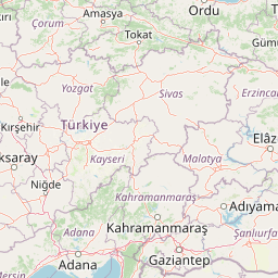
| Hall in Tirol, Innsbruck, Austria to Istanbul, Istanbul, Turkey | 964.80 mi (1,552.70 km) |
| Hall in Tirol, Innsbruck, Austria to London, Westminster, United Kingdom | 597.83 mi (962.11 km) |
| Hall in Tirol, Innsbruck, Austria to Paris, Paris, France | 435.82 mi (701.38 km) |
| Hall in Tirol, Innsbruck, Austria to Madrid, Madrid, Spain | 891.47 mi (1,434.69 km) |
| Hall in Tirol, Innsbruck, Austria to Ankara, Ankara, Turkey | 1,177.67 mi (1,895.28 km) |
12345
 Connectez-vous avec Google