Distance Calculator

A 85, L'Arverne

339.1 km, 3 h 32 min

Head southwest on Rue Émile Zola45 m
Turn left onto Rue Chaptal100 m
Turn left onto Rue de la Préfecture150 m
Turn left onto Rue de Buffon150 m
Turn right onto Rue de la Scellerie200 m
Continue onto Place François Sicard100 m
Turn left onto Rue Lavoisier300 m
Turn right onto Avenue André Malraux800 m
Enter Carrefour des Français Libres and take the 1st exit onto Avenue Georges Pompidou15 m
Exit the traffic circle onto Avenue Georges Pompidou250 m
Enter Rond-Point des Justes and take the 2nd exit onto Avenue Georges Pompidou30 m
Exit the traffic circle onto Avenue Georges Pompidou70 m
Take the ramp on the right towards Poitiers350 m
Merge left onto L'Aquitaine (A 10)10 km
Take the ramp towards A 85: Lyon300 m
Keep left towards A 85: Lyon500 m
Keep right towards Lyon800 m
Merge left onto A 8580 km
Continue onto A 8530 km
Keep left towards A 71: Lyon200 m
Merge left onto L'Arverne (A 71)5 km
Keep left towards A 71: Lyon200 km
Take exit 15 towards Clermont-Ferrand550 m
Merge left onto A 7101 km
Continue onto M 693 km
Continue onto Boulevard Daniel Mayer (M 69)400 m
Enter the traffic circle and take the 2nd exit onto Boulevard Daniel Mayer (M 69)40 m
Exit the traffic circle onto Boulevard Daniel Mayer (M 69)350 m
Turn left onto Rue Fontaine du Large450 m
Keep left onto Rue Thévenot Thibaud250 m
Turn right onto Boulevard Jean-Baptiste Dumas400 m
Turn left onto Rue de Blanzat550 m
Turn right onto Rue Bergier150 m
Turn right onto Rue Gaultier de Biauzat5.5 m
Turn left onto Rue du Pérou35 m
You have arrived at your destination, on the right0 m
From
    To

      Distance: 159.03 mi (255.94 km)

      Driving route: 210.72 mi (339.12 km).

      Driving time: 3h 31 min

      Distance from Clermont-Ferrand to Tours

      The shortest distance (air line) between Clermont-Ferrand and Tours is 159.03mi (255.94 km)

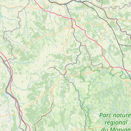
      The shortest route between Clermont-Ferrand and Tours is 210.72 mi (339.12 km) according to the route planner. The driving time is approx. 3 h 31 m

      How far is it between Clermont-Ferrand and Tours.

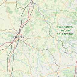
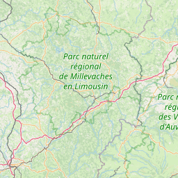
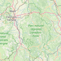
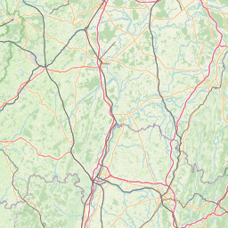
      Clermont-Ferrand is located in Puy-de-Dome, Francecountry within 45° 46' 59.16" N 3° 4' 56.64" E (45.7831, 3.0824) coordinates. The local time in Clermont-Ferrand is 14:52 (21.03.2025)

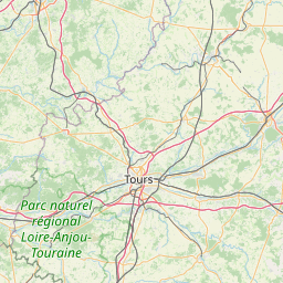
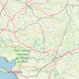
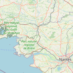
      Tours is located in Indre-et-Loire, Francecountry within 47° 23' 36.96" N 0° 41' 21.12" E (47.3936, 0.6892) coordinates. The local time in Tours is 14:52 (21.03.2025)

      The calculated flying distance from Clermont-Ferrand to Tours is 159.03miles which is equal to 255.94 km.

      If you want to go by car, the driving driving distance between Clermont-Ferrand and Tours is 210.72 miles (339.12 km). If you ride your car with an average speef of 112 kilometers/hour (70 miles/h), travel time will be 3 hours 2 minutes.Please check the avg.speed travel time on the right for various options

      Estimated Travel Time Between Clermont-Ferrand and Tours

      Average speedTravel Time
      30 mph (48 km/h)7 hours 1 minutes
      40 mph (64 km/h)5 hours 16 minutes
      50 mph (80 km/h)4 hours 13 minutes
      60 mph (67 km/h)3 hours 31 minutes
      70 mph (112 km/h)3 hours 1 minutes
      75 mph (120 km/h)2 hours 49 minutes

      Clermont-Ferrand, Puy-de-Dome, France

      Related Distances from Clermont-Ferrand

      CitiesDistance
      Clermont-Ferrand to Saint-Etienne67.64 mi (108.86 km)
      Clermont-Ferrand to Lyon84.72 mi (136.34 km)
      Clermont-Ferrand to Villeurbanne86.65 mi (139.45 km)
      Clermont-Ferrand to Grenoble134.69 mi (216.77 km)
      Clermont-Ferrand to Dijon140.26 mi (225.73 km)
      Clermont-Ferrand to Nimes148.28 mi (238.64 km)
      Clermont-Ferrand to Montpellier155.01 mi (249.46 km)
      Clermont-Ferrand to Tours159.03 mi (255.94 km)
      Clermont-Ferrand to Toulouse170.68 mi (274.68 km)
      Clermont-Ferrand to Bordeaux189.49 mi (304.95 km)
      Clermont-Ferrand to Aix-en-Provence194.41 mi (312.87 km)
      Clermont-Ferrand to Le Mans205.31 mi (330.42 km)
      Clermont-Ferrand to Marseille205.43 mi (330.61 km)
      Clermont-Ferrand to Angers208.33 mi (335.28 km)
      Clermont-Ferrand to Boulogne-Billancourt214.53 mi (345.25 km)
      Clermont-Ferrand to Paris215.10 mi (346.17 km)
      Clermont-Ferrand to Toulon231.14 mi (371.98 km)
      Clermont-Ferrand to Nantes241.67 mi (388.93 km)
      Clermont-Ferrand to Reims244.49 mi (393.47 km)
      Clermont-Ferrand to Nice250.56 mi (403.23 km)
      Clermont-Ferrand to Rennes276.32 mi (444.69 km)
      Clermont-Ferrand to Le Havre291.28 mi (468.77 km)
      Clermont-Ferrand to Strasbourg292.12 mi (470.12 km)
      Clermont-Ferrand to Lille334.74 mi (538.71 km)
      Clermont-Ferrand to Brest398.94 mi (642.04 km)

      Tours, Indre-et-Loire, France

      Related Distances to Tours

      CitiesDistance
      Le Mans to Tours48.18 mi (77.54 km)
      Angers to Tours58.38 mi (93.95 km)
      Nantes to Tours105.73 mi (170.16 km)
      Rennes to Tours120.78 mi (194.37 km)
      Boulogne-Billancourt to Tours122.65 mi (197.39 km)
      Paris to Tours126.89 mi (204.20 km)
      Le Havre to Tours147.34 mi (237.12 km)
      Clermont-Ferrand to Tours159.03 mi (255.94 km)
      Bordeaux to Tours186.61 mi (300.32 km)
      Reims to Tours200.71 mi (323.01 km)
      Dijon to Tours202.60 mi (326.06 km)
      Saint-Etienne to Tours222.22 mi (357.63 km)
      Lyon to Tours227.12 mi (365.51 km)
      Villeurbanne to Tours228.54 mi (367.80 km)
      Lille to Tours247.88 mi (398.93 km)
      Brest to Tours249.57 mi (401.65 km)
      Toulouse to Tours264.34 mi (425.41 km)
      Grenoble to Tours285.10 mi (458.83 km)
      Nimes to Tours302.98 mi (487.59 km)
      Montpellier to Tours303.43 mi (488.32 km)
      Strasbourg to Tours336.37 mi (541.34 km)
      Aix-en-Provence to Tours352.75 mi (567.69 km)
      Marseille to Tours362.91 mi (584.05 km)
      Toulon to Tours389.60 mi (627.00 km)
      Nice to Tours407.54 mi (655.87 km)