Distance Calculator

M6, A14

305.6 km, 3 h 31 min

Head southwest on Paul Ware Street15 m
Turn right onto Boothen Old Road30 m
Make a sharp left onto Campbell Road (A5006)1 km
Enter Michelin Roundabout and take the 1st exit onto A500610 m
Exit the traffic circle onto A5006400 m
Enter the traffic circle and take the 3rd exit70 m
Exit the traffic circle400 m
Merge right onto Queensway (A500)2.5 km
Enter Hanchurch Roundabout and take the 2nd exit onto M660 m
Exit the traffic circle onto M690 m
Keep left onto M635 km
Keep left onto M615 km
Keep right onto M660 km
Continue towards A14: Felixstowe30 km
Take the ramp on the left450 m
Enter Broughton Interchange and take the 2nd exit90 m
Exit the traffic circle600 m
Continue onto A1460 km
Keep left onto A1430 km
Keep right onto A1455 km
Take the ramp on the left600 m
Enter Whitehouse Interchange and take the 1st exit onto Bury Road (A1156)15 m
Exit the traffic circle onto Bury Road (A1156)350 m
Enter the traffic circle and take the 2nd exit onto Bury Road40 m
Exit the traffic circle onto Bury Road550 m
Continue slightly right onto Norwich Road (A1156)2 km
Turn right15 m
Turn left onto Norwich Road (A1156)700 m
Continue onto St Matthew's Street (A1156)150 m
Enter the traffic circle and take the 2nd exit onto St Matthew's Street (A1156)30 m
Exit the traffic circle onto St Matthew's Street (A1156)100 m
Continue onto Crown Street (A1156)400 m
You have arrived at your destination0 m

A50, A14

307.0 km, 3 h 33 min

Head southwest on Paul Ware Street15 m
Turn right onto Boothen Old Road30 m
Make a sharp left onto Campbell Road (A5006)1 km
Enter Michelin Roundabout and take the 1st exit onto A500610 m
Exit the traffic circle onto A5006150 m
Take the ramp on the left250 m
Enter Sideway Roundabout and take the 2nd exit onto A50100 m
Exit the traffic circle onto A5010 km
Enter the traffic circle and take the 2nd exit onto A5080 m
Exit the traffic circle onto A5015 km
Enter McDonalds Roundabout and take the 2nd exit onto A5045 m
Exit the traffic circle onto A501.5 km
Enter the traffic circle and take the 1st exit onto Derby Road (A50)50 m
Exit the traffic circle onto Derby Road (A50)8 km
Enter the traffic circle and take the 2nd exit onto Main Road (A50)60 m
Exit the traffic circle onto Main Road (A50)35 km
Take the ramp towards M1: The SOUTH600 m
Merge right onto M155 km
Take the ramp on the left towards A14: Felixstowe1 km
Continue towards A14: Felixstowe30 km
Take the ramp on the left450 m
Enter Broughton Interchange and take the 2nd exit90 m
Exit the traffic circle600 m
Continue onto A1460 km
Keep left onto A1430 km
Keep right onto A1455 km
Take the ramp on the left600 m
Enter Whitehouse Interchange and take the 1st exit onto Bury Road (A1156)15 m
Exit the traffic circle onto Bury Road (A1156)350 m
Enter the traffic circle and take the 2nd exit onto Bury Road40 m
Exit the traffic circle onto Bury Road550 m
Continue slightly right onto Norwich Road (A1156)2 km
Turn right15 m
Turn left onto Norwich Road (A1156)700 m
Continue onto St Matthew's Street (A1156)150 m
Enter the traffic circle and take the 2nd exit onto St Matthew's Street (A1156)30 m
Exit the traffic circle onto St Matthew's Street (A1156)100 m
Continue onto Crown Street (A1156)400 m
You have arrived at your destination0 m
From
    To

      Distance: 154.64 mi (248.87 km)

      Driving route: 189.90 mi (305.61 km).

      Driving time: 3h 30 min

      Distance from Stoke-on-Trent to Ipswich

      The shortest distance (air line) between Stoke-on-Trent and Ipswich is 154.64mi (248.87 km)

      The shortest route between Stoke-on-Trent and Ipswich is 189.90 mi (305.61 km) according to the route planner. The driving time is approx. 3 h 30 m

      How far is it between Stoke-on-Trent and Ipswich.

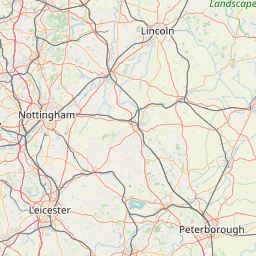
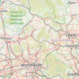
      Stoke-on-Trent is located in Stoke-on-Trent, United Kingdomcountry within 53° 0' 0" N -3° 49' 0.12" W (53.0000, -2.1833) coordinates. The local time in Stoke-on-Trent is 06:11 (18.03.2025)

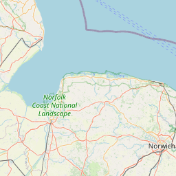
      Ipswich is located in Suffolk, United Kingdomcountry within 52° 3' 33.84" N 1° 9' 20.16" E (52.0594, 1.1556) coordinates. The local time in Ipswich is 06:11 (18.03.2025)

      The calculated flying distance from Stoke-on-Trent to Ipswich is 154.64miles which is equal to 248.87 km.

      If you want to go by car, the driving driving distance between Stoke-on-Trent and Ipswich is 189.90 miles (305.61 km). If you ride your car with an average speef of 112 kilometers/hour (70 miles/h), travel time will be 2 hours 44 minutes.Please check the avg.speed travel time on the right for various options

      Estimated Travel Time Between Stoke-on-Trent and Ipswich

      Average speedTravel Time
      30 mph (48 km/h)6 hours 20 minutes
      40 mph (64 km/h)4 hours 45 minutes
      50 mph (80 km/h)3 hours 48 minutes
      60 mph (67 km/h)3 hours 10 minutes
      70 mph (112 km/h)2 hours 43 minutes
      75 mph (120 km/h)2 hours 32 minutes

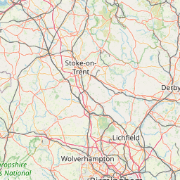
      Stoke-on-Trent, Stoke-on-Trent, United Kingdom

      Related Distances from Stoke-on-Trent

      CitiesDistance
      Stoke-on-Trent to Stockport28.25 mi (45.46 km)
      Stoke-on-Trent to Manchester33.22 mi (53.47 km)
      Stoke-on-Trent to Birmingham37.80 mi (60.83 km)
      Stoke-on-Trent to Sheffield39.54 mi (63.63 km)
      Stoke-on-Trent to Bolton41.21 mi (66.31 km)
      Stoke-on-Trent to Nottingham43.11 mi (69.38 km)
      Stoke-on-Trent to Liverpool43.73 mi (70.38 km)
      Stoke-on-Trent to Coventry49.66 mi (79.91 km)
      Stoke-on-Trent to Leicester50.65 mi (81.52 km)
      Stoke-on-Trent to Bradford58.09 mi (93.48 km)
      Stoke-on-Trent to Leeds61.15 mi (98.40 km)
      Stoke-on-Trent to Kingston upon Hull92.01 mi (148.07 km)
      Stoke-on-Trent to Bristol108.27 mi (174.25 km)
      Stoke-on-Trent to Caerdydd113.05 mi (181.93 km)
      Stoke-on-Trent to Reading118.45 mi (190.62 km)
      Stoke-on-Trent to London134.89 mi (217.09 km)
      Stoke-on-Trent to Sunderland135.67 mi (218.34 km)
      Stoke-on-Trent to Newcastle138.77 mi (223.33 km)
      Stoke-on-Trent to Southampton148.67 mi (239.26 km)
      Stoke-on-Trent to Ipswich154.64 mi (248.87 km)
      Stoke-on-Trent to Portsmouth158.64 mi (255.30 km)
      Stoke-on-Trent to Worthing169.58 mi (272.92 km)
      Stoke-on-Trent to Belfast188.49 mi (303.35 km)
      Stoke-on-Trent to Edinburgh208.00 mi (334.75 km)
      Stoke-on-Trent to Glasgow214.40 mi (345.04 km)

      Ipswich, Suffolk, United Kingdom

      Related Distances to Ipswich

      CitiesDistance
      London to Ipswich66.81 mi (107.52 km)
      Reading to Ipswich100.18 mi (161.22 km)
      Leicester to Ipswich104.40 mi (168.01 km)
      Worthing to Ipswich108.26 mi (174.23 km)
      Nottingham to Ipswich114.95 mi (185.00 km)
      Coventry to Ipswich115.36 mi (185.65 km)
      Portsmouth to Ipswich129.74 mi (208.80 km)
      Kingston upon Hull to Ipswich131.90 mi (212.28 km)
      Birmingham to Ipswich132.51 mi (213.26 km)
      Southampton to Ipswich136.08 mi (219.00 km)
      Sheffield to Ipswich142.86 mi (229.91 km)
      Stoke-on-Trent to Ipswich154.64 mi (248.87 km)
      Leeds to Ipswich164.79 mi (265.20 km)
      Bristol to Ipswich165.86 mi (266.93 km)
      Stockport to Ipswich166.72 mi (268.31 km)
      Bradford to Ipswich170.58 mi (274.53 km)
      Manchester to Ipswich172.71 mi (277.95 km)
      Bolton to Ipswich182.76 mi (294.12 km)
      Caerdydd to Ipswich189.56 mi (305.06 km)
      Liverpool to Ipswich196.90 mi (316.88 km)
      Sunderland to Ipswich222.59 mi (358.22 km)
      Newcastle to Ipswich231.53 mi (372.62 km)
      Edinburgh to Ipswich321.59 mi (517.55 km)
      Belfast to Ipswich340.67 mi (548.26 km)
      Glasgow to Ipswich342.26 mi (550.81 km)