Distance Calculator

Autoroute des Cigognes, La Comtoise

620.8 km, 6 h 37 min

Head southwest on Rue du Fossé des Tanneurs150 m
Turn right onto Rue du 22 Novembre200 m
Continue onto Petite Rue du Vieux Marché aux Vins150 m
Turn left onto Quai Saint-Jean300 m
Continue onto Quai Charles Altorffer150 m
Turn right onto Rue Sainte-Marguerite150 m
Turn left onto Rue de Molsheim1 km
Take the ramp500 m
Keep right towards A 35: Meinau200 m
Keep left towards A 35: Illkirch-Graffenstaden450 m
Go straight towards A 35: Mulhouse200 m
Merge left onto M 3515 km
Keep right towards A 35: Saint-Dié des Vosges par tunnel90 km
Take the ramp on the left towards A 36: Paris1.5 km
Merge left onto La Comtoise (A 36)250 km
Merge left onto Autoroute de Lorraine-Bourgogne (A 31)4.5 km
Merge right onto Autoroute du Soleil (A 6)30 km
Take exit 26 towards N 80: Montceau-les-Mines1 km
Keep left at the fork35 m
Enter the traffic circle and take the 2nd exit onto N 80100 m
Exit the traffic circle onto N 80600 m
Enter the traffic circle and take the 2nd exit onto Route Centre-Europe Atlantique45 m
Exit the traffic circle onto Route Centre-Europe Atlantique25 km
Enter Rond-Point Jeanne Rose and take the 3rd exit onto N 70200 m
Exit the traffic circle onto N 7045 km
Continue onto Route Centre-Europe Atlantique (N 79)10 km
Continue towards Montluçon90 km
Take the ramp1.5 km
Keep left onto Route Centre Europe Atlantique700 m
Merge left onto L'Arverne (A 71)70 km
Take exit 15 towards Clermont-Ferrand550 m
Merge left onto A 7101 km
Continue onto M 693 km
Continue onto Boulevard Daniel Mayer (M 69)400 m
Enter the traffic circle and take the 2nd exit onto Boulevard Daniel Mayer (M 69)40 m
Exit the traffic circle onto Boulevard Daniel Mayer (M 69)350 m
Turn left onto Rue Fontaine du Large450 m
Keep left onto Rue Thévenot Thibaud250 m
Turn right onto Boulevard Jean-Baptiste Dumas400 m
Turn left onto Rue de Blanzat550 m
Turn right onto Rue Bergier150 m
Turn right onto Rue Gaultier de Biauzat5.5 m
Turn left onto Rue du Pérou35 m
You have arrived at your destination, on the right0 m

La Comtoise, Autoroute du Soleil

629.6 km, 6 h 37 min

Head southwest on Rue du Fossé des Tanneurs150 m
Turn right onto Rue du 22 Novembre200 m
Continue onto Petite Rue du Vieux Marché aux Vins150 m
Turn left onto Quai Saint-Jean300 m
Continue onto Quai Charles Altorffer150 m
Turn right onto Rue Sainte-Marguerite150 m
Turn left onto Rue de Molsheim1 km
Take the ramp500 m
Keep right towards A 35: Meinau200 m
Keep left towards A 35: Illkirch-Graffenstaden450 m
Go straight towards A 35: Mulhouse200 m
Merge left onto M 3515 km
Keep right towards A 35: Saint-Dié des Vosges par tunnel90 km
Take the ramp on the left towards A 36: Paris1.5 km
Merge left onto La Comtoise (A 36)250 km
Merge left onto Autoroute de Lorraine-Bourgogne (A 31)4.5 km
Merge right onto Autoroute du Soleil (A 6)150 km
Keep left towards A 6: Clermont-Ferrand10 km
Take the ramp towards A 89: Bordeaux700 m
Continue onto La Transeuropéenne (A 89)60 km
Keep right towards Bordeaux80 km
Keep left towards A 896 km
Continue towards Clermont Ferrand2 km
Continue onto M 693 km
Continue onto Boulevard Daniel Mayer (M 69)400 m
Enter the traffic circle and take the 2nd exit onto Boulevard Daniel Mayer (M 69)40 m
Exit the traffic circle onto Boulevard Daniel Mayer (M 69)350 m
Turn left onto Rue Fontaine du Large450 m
Keep left onto Rue Thévenot Thibaud250 m
Turn right onto Boulevard Jean-Baptiste Dumas400 m
Turn left onto Rue de Blanzat550 m
Turn right onto Rue Bergier150 m
Turn right onto Rue Gaultier de Biauzat5.5 m
Turn left onto Rue du Pérou35 m
You have arrived at your destination, on the right0 m
From
    To

      Distance: 292.12 mi (470.12 km)

      Driving route: 385.74 mi (620.79 km).

      Driving time: 6h 36 min

      Distance from Strasbourg to Clermont-Ferrand

      The shortest distance (air line) between Strasbourg and Clermont-Ferrand is 292.12mi (470.12 km)

      The shortest route between Strasbourg and Clermont-Ferrand is 385.74 mi (620.79 km) according to the route planner. The driving time is approx. 6 h 36 m

      How far is it between Strasbourg and Clermont-Ferrand.

      Strasbourg is located in Bas-Rhin, Francecountry within 48° 34' 59.88" N 7° 44' 44.88" E (48.5833, 7.7458) coordinates. The local time in Strasbourg is 17:24 (22.03.2025)

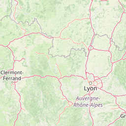
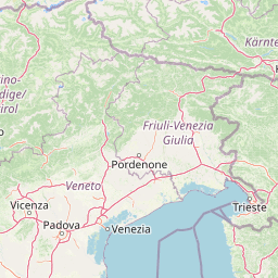
      Clermont-Ferrand is located in Puy-de-Dome, Francecountry within 45° 46' 59.16" N 3° 4' 56.64" E (45.7831, 3.0824) coordinates. The local time in Clermont-Ferrand is 17:24 (22.03.2025)

      The calculated flying distance from Strasbourg to Clermont-Ferrand is 292.12miles which is equal to 470.12 km.

      If you want to go by car, the driving driving distance between Strasbourg and Clermont-Ferrand is 385.74 miles (620.79 km). If you ride your car with an average speef of 112 kilometers/hour (70 miles/h), travel time will be 5 hours 33 minutes.Please check the avg.speed travel time on the right for various options

      Estimated Travel Time Between Strasbourg and Clermont-Ferrand

      Average speedTravel Time
      30 mph (48 km/h)12 hours 51 minutes
      40 mph (64 km/h)9 hours 39 minutes
      50 mph (80 km/h)7 hours 43 minutes
      60 mph (67 km/h)6 hours 26 minutes
      70 mph (112 km/h)5 hours 31 minutes
      75 mph (120 km/h)5 hours 9 minutes

      Strasbourg, Bas-Rhin, France

      Related Distances from Strasbourg

      CitiesDistance
      Strasbourg to Dijon153.64 mi (247.26 km)
      Strasbourg to Reims174.88 mi (281.44 km)
      Strasbourg to Villeurbanne236.57 mi (380.73 km)
      Strasbourg to Lyon238.04 mi (383.08 km)
      Strasbourg to Paris246.53 mi (396.75 km)
      Strasbourg to Boulogne-Billancourt251.53 mi (404.80 km)
      Strasbourg to Lille252.92 mi (407.04 km)
      Strasbourg to Grenoble254.34 mi (409.32 km)
      Strasbourg to Saint-Etienne268.86 mi (432.69 km)
      Strasbourg to Clermont-Ferrand292.12 mi (470.12 km)
      Strasbourg to Tours336.37 mi (541.34 km)
      Strasbourg to Nice337.95 mi (543.87 km)
      Strasbourg to Le Mans349.06 mi (561.75 km)
      Strasbourg to Le Havre351.78 mi (566.14 km)
      Strasbourg to Nimes365.54 mi (588.28 km)
      Strasbourg to Aix-en-Provence366.35 mi (589.59 km)
      Strasbourg to Marseille382.66 mi (615.83 km)
      Strasbourg to Toulon387.03 mi (622.87 km)
      Strasbourg to Montpellier390.18 mi (627.94 km)
      Strasbourg to Angers390.90 mi (629.09 km)
      Strasbourg to Rennes433.73 mi (698.01 km)
      Strasbourg to Nantes440.63 mi (709.13 km)
      Strasbourg to Toulouse457.41 mi (736.12 km)
      Strasbourg to Bordeaux471.26 mi (758.42 km)
      Strasbourg to Brest559.89 mi (901.06 km)

      Clermont-Ferrand, Puy-de-Dome, France

      Related Distances to Clermont-Ferrand

      CitiesDistance
      Saint-Etienne to Clermont-Ferrand67.64 mi (108.86 km)
      Lyon to Clermont-Ferrand84.72 mi (136.34 km)
      Villeurbanne to Clermont-Ferrand86.65 mi (139.45 km)
      Grenoble to Clermont-Ferrand134.69 mi (216.77 km)
      Dijon to Clermont-Ferrand140.26 mi (225.73 km)
      Nimes to Clermont-Ferrand148.28 mi (238.64 km)
      Montpellier to Clermont-Ferrand155.01 mi (249.46 km)
      Tours to Clermont-Ferrand159.03 mi (255.94 km)
      Toulouse to Clermont-Ferrand170.68 mi (274.68 km)
      Bordeaux to Clermont-Ferrand189.49 mi (304.95 km)
      Aix-en-Provence to Clermont-Ferrand194.41 mi (312.87 km)
      Le Mans to Clermont-Ferrand205.31 mi (330.42 km)
      Marseille to Clermont-Ferrand205.43 mi (330.61 km)
      Angers to Clermont-Ferrand208.33 mi (335.28 km)
      Boulogne-Billancourt to Clermont-Ferrand214.53 mi (345.25 km)
      Paris to Clermont-Ferrand215.10 mi (346.17 km)
      Toulon to Clermont-Ferrand231.14 mi (371.98 km)
      Nantes to Clermont-Ferrand241.67 mi (388.93 km)
      Reims to Clermont-Ferrand244.49 mi (393.47 km)
      Nice to Clermont-Ferrand250.56 mi (403.23 km)
      Rennes to Clermont-Ferrand276.32 mi (444.69 km)
      Le Havre to Clermont-Ferrand291.28 mi (468.77 km)
      Strasbourg to Clermont-Ferrand292.12 mi (470.12 km)
      Lille to Clermont-Ferrand334.74 mi (538.71 km)
      Brest to Clermont-Ferrand398.94 mi (642.04 km)