Distance Calculator

L’Océane, N 118

201.6 km, 2 h 13 min

Head southeast on Rond-point du tunnel55 m
Exit the traffic circle onto Rue Wilbur Wright250 m
Keep straight onto Pont Yssoir90 m
Make a slight right onto Quai Ledru Rollin20 m
Turn right onto Rue Voltaire40 m
Turn right onto Rue du Pré250 m
Continue slightly left onto Rue Édouard de la Boussinière250 m
Turn right onto Rue Philippe150 m
Turn left onto Rue de Claircigny150 m
Turn right onto Rue de la Madeleine550 m
Continue onto Rue du Léard700 m
Turn left onto Rue Thomas Edison70 m
Enter the traffic circle and take the 1st exit towards A 11 - A 2810 m
Exit the traffic circle towards A 11 - A 28200 m
Keep left onto Avenue Rhin et Danube150 m
Enter Route d'Alençon and take the 2nd exit towards D 338: A 11 - A 28150 m
Exit the traffic circle towards D 338: A 11 - A 282 km
Keep right towards A 11 - A 28200 m
Enter Giratoire de l'Océane and take the 2nd exit towards A 28: Alençon60 m
Exit the traffic circle towards A 28: Alençon250 m
Continue towards Paris100 m
Keep left towards A 11: Paris1.5 km
Merge left onto L’Océane (A 11)150 km
Merge left onto L'Aquitaine (A 10)25 km
Take the ramp towards N 118: A13 Rouen300 m
Merge right onto La Francilienne (N 104)900 m
Continue towards Rouen25 km
Go straight onto Pont de Sèvres (D 910)250 m
Continue onto Avenue du Général Leclerc (D 910)1 km
Enter Place Marcel Sembat and take the 7th exit onto Avenue André Morizet (D 50)90 m
Exit the traffic circle onto Avenue André Morizet (D 50)250 m
Make a U-turn and continue on Avenue André Morizet (D 50)30 m
You have arrived at your destination0 m

L’Océane, N 10

202.3 km, 2 h 18 min

Head southeast on Rond-point du tunnel55 m
Exit the traffic circle onto Rue Wilbur Wright250 m
Keep straight onto Pont Yssoir90 m
Make a slight right onto Quai Ledru Rollin20 m
Turn right onto Rue Voltaire40 m
Turn right onto Rue du Pré250 m
Continue slightly left onto Rue Édouard de la Boussinière250 m
Turn right onto Rue Philippe150 m
Turn left onto Rue de Claircigny150 m
Turn right onto Rue de la Madeleine550 m
Continue onto Rue du Léard700 m
Turn left onto Rue Thomas Edison70 m
Enter the traffic circle and take the 1st exit towards A 11 - A 2810 m
Exit the traffic circle towards A 11 - A 28200 m
Keep left onto Avenue Rhin et Danube150 m
Enter Route d'Alençon and take the 2nd exit towards D 338: A 11 - A 28150 m
Exit the traffic circle towards D 338: A 11 - A 282 km
Keep right towards A 11 - A 28200 m
Enter Giratoire de l'Océane and take the 2nd exit towards A 28: Alençon60 m
Exit the traffic circle towards A 28: Alençon250 m
Continue towards Paris100 m
Keep left towards A 11: Paris1.5 km
Merge left onto L’Océane (A 11)150 km
Take exit 1 towards Étampes1 km
Enter the traffic circle and take the 2nd exit towards N 10: Rambouillet90 m
Exit the traffic circle towards N 10: Rambouillet150 m
Merge left onto N 1035 km
Enter Carrefour du Pavillon bleu and take the 2nd exit onto N 1045 m
Exit the traffic circle onto N 102 km
Keep left towards A 12: Créteil100 m
Continue onto A 128 km
Merge left onto Autoroute de Normandie (A 13)8 km
Continue onto Tunnel de Saint-Cloud (A 13)900 m
Take exit 3 towards Suresnes250 m
Keep left at the fork200 m
Continue onto Pont de Saint-Cloud (D 907)150 m
Continue onto Avenue du Maréchal de Lattre de Tassigny (D 907)250 m
Enter Rond-Point Rhin et Danube and take the 2nd exit towards Centre-Ville55 m
Exit the traffic circle towards Centre-Ville1 km
You have arrived at your destination0 m
From
    To

      Distance: 109.72 mi (176.58 km)

      Driving route: 125.27 mi (201.59 km).

      Driving time: 2h 12 min

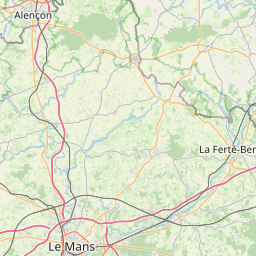
      Distance from Le Mans to Boulogne-Billancourt

      The shortest distance (air line) between Le Mans and Boulogne-Billancourt is 109.72mi (176.58 km)

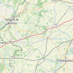
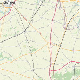
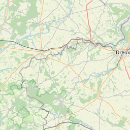
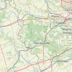
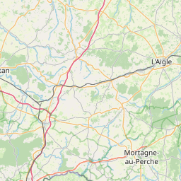
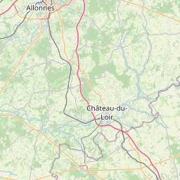
      The shortest route between Le Mans and Boulogne-Billancourt is 125.27 mi (201.59 km) according to the route planner. The driving time is approx. 2 h 12 m

      How far is it between Le Mans and Boulogne-Billancourt.

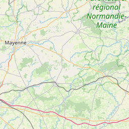
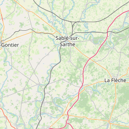
      Le Mans is located in Sarthe, Francecountry within 48° 0' 27.72" N 0° 11' 54.24" E (48.0077, 0.1984) coordinates. The local time in Le Mans is 17:31 (22.03.2025)

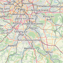
      Boulogne-Billancourt is located in Hauts-de-Seine, Francecountry within 48° 50' 6.72" N 2° 14' 27.24" E (48.8352, 2.2409) coordinates. The local time in Boulogne-Billancourt is 17:31 (22.03.2025)

      The calculated flying distance from Le Mans to Boulogne-Billancourt is 109.72miles which is equal to 176.58 km.

      If you want to go by car, the driving driving distance between Le Mans and Boulogne-Billancourt is 125.27 miles (201.59 km). If you ride your car with an average speef of 112 kilometers/hour (70 miles/h), travel time will be 1 hours 48 minutes.Please check the avg.speed travel time on the right for various options

      Estimated Travel Time Between Le Mans and Boulogne-Billancourt

      Average speedTravel Time
      30 mph (48 km/h)4 hours 11 minutes
      40 mph (64 km/h)3 hours 8 minutes
      50 mph (80 km/h)2 hours 30 minutes
      60 mph (67 km/h)2 hours 5 minutes
      70 mph (112 km/h)1 hours 47 minutes
      75 mph (120 km/h)1 hours 40 minutes

      Le Mans, Sarthe, France

      Related Distances from Le Mans

      CitiesDistance
      Le Mans to Tours48.18 mi (77.54 km)
      Le Mans to Angers50.84 mi (81.82 km)
      Le Mans to Rennes87.02 mi (140.05 km)
      Le Mans to Nantes98.13 mi (157.92 km)
      Le Mans to Le Havre102.52 mi (164.98 km)
      Le Mans to Boulogne-Billancourt109.72 mi (176.58 km)
      Le Mans to Paris114.84 mi (184.82 km)
      Le Mans to Reims195.43 mi (314.51 km)
      Le Mans to Clermont-Ferrand205.31 mi (330.42 km)
      Le Mans to Brest217.49 mi (350.02 km)
      Le Mans to Bordeaux221.98 mi (357.24 km)
      Le Mans to Lille222.14 mi (357.50 km)
      Le Mans to Dijon229.20 mi (368.86 km)
      Le Mans to Saint-Etienne266.44 mi (428.80 km)
      Le Mans to Lyon268.56 mi (432.20 km)
      Le Mans to Villeurbanne269.83 mi (434.26 km)
      Le Mans to Toulouse310.08 mi (499.02 km)
      Le Mans to Grenoble327.28 mi (526.70 km)
      Le Mans to Strasbourg349.06 mi (561.75 km)
      Le Mans to Nimes350.63 mi (564.29 km)
      Le Mans to Montpellier351.52 mi (565.72 km)
      Le Mans to Aix-en-Provence399.59 mi (643.07 km)
      Le Mans to Marseille410.10 mi (659.99 km)
      Le Mans to Toulon436.38 mi (702.29 km)
      Le Mans to Nice451.47 mi (726.57 km)

      Boulogne-Billancourt, Hauts-de-Seine, France

      Related Distances to Boulogne-Billancourt

      CitiesDistance
      Paris to Boulogne-Billancourt5.27 mi (8.49 km)
      Reims to Boulogne-Billancourt86.43 mi (139.10 km)
      Le Havre to Boulogne-Billancourt106.78 mi (171.85 km)
      Le Mans to Boulogne-Billancourt109.72 mi (176.58 km)
      Tours to Boulogne-Billancourt122.65 mi (197.39 km)
      Lille to Boulogne-Billancourt129.12 mi (207.80 km)
      Angers to Boulogne-Billancourt159.51 mi (256.71 km)
      Dijon to Boulogne-Billancourt165.60 mi (266.50 km)
      Rennes to Boulogne-Billancourt186.32 mi (299.85 km)
      Nantes to Boulogne-Billancourt207.84 mi (334.49 km)
      Clermont-Ferrand to Boulogne-Billancourt214.53 mi (345.25 km)
      Lyon to Boulogne-Billancourt244.87 mi (394.08 km)
      Villeurbanne to Boulogne-Billancourt245.41 mi (394.95 km)
      Strasbourg to Boulogne-Billancourt251.53 mi (404.80 km)
      Saint-Etienne to Boulogne-Billancourt255.72 mi (411.55 km)
      Grenoble to Boulogne-Billancourt301.57 mi (485.33 km)
      Bordeaux to Boulogne-Billancourt306.50 mi (493.26 km)
      Brest to Boulogne-Billancourt308.91 mi (497.13 km)
      Nimes to Boulogne-Billancourt359.74 mi (578.95 km)
      Toulouse to Boulogne-Billancourt363.40 mi (584.84 km)
      Montpellier to Boulogne-Billancourt369.25 mi (594.25 km)
      Aix-en-Provence to Boulogne-Billancourt397.46 mi (639.65 km)
      Marseille to Boulogne-Billancourt410.95 mi (661.36 km)
      Nice to Boulogne-Billancourt427.96 mi (688.73 km)
      Toulon to Boulogne-Billancourt432.30 mi (695.72 km)