Distance Calculator

A1, Rruga e Kombit

211.5 km, 3 h 10 min

Head southwest on Rruga Jakup Biçaku500 m
Turn left to stay on Rruga Jakup Biçaku2 km
Keep left at the fork250 m
Turn left200 m
Turn left onto Rruga Jakup Biçaku80 m
Continue slightly right onto Rruga Shebeniku300 m
Make a sharp right onto SH310 km
Continue onto A35 km
Continue slightly left onto SH38 km
Make a slight right towards Elbasan Qendër70 m
Go straight onto Rruga Kozma Naska1 km
Continue onto Rruga Tomorr Domi400 m
Make a slight right onto Bulevardi Aqif Pasha600 m
Turn right35 m
Continue right onto Rruga Lublin Djlia150 m
Enter the traffic circle and take the 1st exit onto Rruga Qemal Stafa30 m
Exit the traffic circle onto Rruga Qemal Stafa700 m
Enter the traffic circle and take the 2nd exit onto Rruga 11 Nëntori (SH3)40 m
Exit the traffic circle onto Rruga 11 Nëntori (SH3)1 km
Continue onto Rruga Elbasan-Metalurgji (SH3)2.5 km
Enter the traffic circle and take the 2nd exit towards SH3: Tiranë30 m
Exit the traffic circle towards SH3: Tiranë700 m
Enter the traffic circle and take the 1st exit towards Autostrada Tiranë-Elbasan: Tiranë9 m
Exit the traffic circle towards Autostrada Tiranë-Elbasan: Tiranë25 km
Continue towards Tiranë9 km
Keep right towards SH1: Durrës700 m
Continue towards SH2: Aeroport8 km
Take the ramp300 m
Merge left onto Autostrada Thumanë Kashar (A1)35 km
Take the ramp towards A1: Kukës100 km
Take the ramp towards SH31: aeroport90 m
Continue straight300 m
Enter the traffic circle and take the 5th exit onto Rruga Bicaj (SH31)100 m
Exit the traffic circle onto Rruga Bicaj (SH31)500 m
Enter the traffic circle and take the 2nd exit onto Rruga Bicaj (SH31)90 m
Exit the traffic circle onto Rruga Bicaj (SH31)500 m
Continue onto Rruga Mahmut Daci (SH31)600 m
Make a slight left150 m
Turn left onto Rruga Islam Spahiu150 m
Continue onto Rruga Dituria550 m
Turn right onto Rruga Dëshmorët600 m
You have arrived at your destination, on the left0 m
From
    To

      Distance: 61.39 mi (98.79 km)

      Driving route: 131.40 mi (211.47 km).

      Driving time: 3h 10 min

      Distance from Librazhd-Qender to Kukes

      The shortest distance (air line) between Librazhd-Qender and Kukes is 61.39mi (98.79 km)

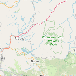
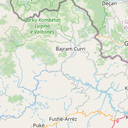
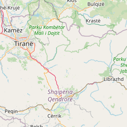
      The shortest route between Librazhd-Qender and Kukes is 131.40 mi (211.47 km) according to the route planner. The driving time is approx. 3 h 10 m

      How far is it between Librazhd-Qender and Kukes.

      Librazhd-Qender is located in Elbasan, Albaniacountry within 41° 11' 48.84" N 20° 20' 8.16" E (41.1969, 20.3356) coordinates. The local time in Librazhd-Qender is 15:49 (21.03.2025)

      Kukes is located in Kukes, Albaniacountry within 42° 4' 59.88" N 20° 25' 0.12" E (42.0833, 20.4167) coordinates. The local time in Kukes is 15:49 (21.03.2025)

      The calculated flying distance from Librazhd-Qender to Kukes is 61.39miles which is equal to 98.79 km.

      If you want to go by car, the driving driving distance between Librazhd-Qender and Kukes is 131.40 miles (211.47 km). If you ride your car with an average speef of 112 kilometers/hour (70 miles/h), travel time will be 1 hours 53 minutes.Please check the avg.speed travel time on the right for various options

      Estimated Travel Time Between Librazhd-Qender and Kukes

      Average speedTravel Time
      30 mph (48 km/h)4 hours 23 minutes
      40 mph (64 km/h)3 hours 17 minutes
      50 mph (80 km/h)2 hours 38 minutes
      60 mph (67 km/h)2 hours 11 minutes
      70 mph (112 km/h)1 hours 53 minutes
      75 mph (120 km/h)1 hours 45 minutes

      Librazhd-Qender, Elbasan, Albania

      Related Distances from Librazhd-Qender

      CitiesDistance
      Librazhd-Qender to Elbasan14.53 mi (23.38 km)
      Librazhd-Qender to Pogradec26.25 mi (42.25 km)
      Librazhd-Qender to Bucimas27.71 mi (44.60 km)
      Librazhd-Qender to Tirana28.40 mi (45.70 km)
      Librazhd-Qender to Kamez32.22 mi (51.85 km)
      Librazhd-Qender to Burrel33.03 mi (53.15 km)
      Librazhd-Qender to Peshkopi33.95 mi (54.63 km)
      Librazhd-Qender to Kruje34.79 mi (55.99 km)
      Librazhd-Qender to Kucove34.92 mi (56.21 km)
      Librazhd-Qender to Fushe-Kruje37.71 mi (60.69 km)
      Librazhd-Qender to Lushnje37.79 mi (60.82 km)
      Librazhd-Qender to Berat39.80 mi (64.04 km)
      Librazhd-Qender to Kavaje40.24 mi (64.76 km)
      Librazhd-Qender to Sukth43.60 mi (70.16 km)
      Librazhd-Qender to Lac44.25 mi (71.21 km)
      Librazhd-Qender to Korce45.98 mi (73.99 km)
      Librazhd-Qender to Durres47.23 mi (76.00 km)
      Librazhd-Qender to Patos51.64 mi (83.11 km)
      Librazhd-Qender to Fier52.08 mi (83.82 km)
      Librazhd-Qender to Lezhe53.98 mi (86.87 km)
      Librazhd-Qender to Kukes61.39 mi (98.79 km)
      Librazhd-Qender to Vlore67.31 mi (108.32 km)
      Librazhd-Qender to Shkoder73.71 mi (118.62 km)
      Librazhd-Qender to Gjirokaster78.81 mi (126.83 km)
      Librazhd-Qender to Sarande92.92 mi (149.54 km)

      Kukes, Kukes, Albania

      Related Distances to Kukes

      CitiesDistance
      Peshkopi to Kukes27.64 mi (44.49 km)
      Burrel to Kukes38.90 mi (62.60 km)
      Lezhe to Kukes44.83 mi (72.14 km)
      Shkoder to Kukes46.41 mi (74.70 km)
      Lac to Kukes47.63 mi (76.66 km)
      Kruje to Kukes51.32 mi (82.59 km)
      Fushe-Kruje to Kukes54.95 mi (88.43 km)
      Kamez to Kukes58.84 mi (94.70 km)
      Tirana to Kukes60.59 mi (97.51 km)
      Librazhd-Qender to Kukes61.39 mi (98.79 km)
      Sukth to Kukes66.44 mi (106.92 km)
      Elbasan to Kukes69.38 mi (111.66 km)
      Durres to Kukes73.41 mi (118.15 km)
      Kavaje to Kukes76.21 mi (122.64 km)
      Pogradec to Kukes82.64 mi (133.00 km)
      Bucimas to Kukes83.46 mi (134.31 km)
      Lushnje to Kukes87.68 mi (141.11 km)
      Kucove to Kukes92.15 mi (148.29 km)
      Berat to Kukes98.59 mi (158.67 km)
      Korce to Kukes102.95 mi (165.67 km)
      Fier to Kukes103.88 mi (167.18 km)
      Patos to Kukes105.24 mi (169.38 km)
      Vlore to Kukes121.76 mi (195.95 km)
      Gjirokaster to Kukes140.11 mi (225.49 km)
      Sarande to Kukes154.05 mi (247.91 km)