| Head southwest on Charing Cross | 20 m |
| Exit the traffic circle onto The Mall | 1 km |
| Turn right onto Constitution Hill | 800 m |
| Keep right onto Duke of Wellington Place (A4) | 45 m |
| Merge left onto Grosvenor Place (A4) | 90 m |
| Keep left onto Knightsbridge (A4) | 700 m |
| Merge right onto Brompton Road (A4) | 800 m |
| Continue onto Thurloe Place (A4) | 200 m |
| Continue onto Cromwell Gardens (A4) | 150 m |
| Continue onto Cromwell Road (A4) | 2.5 km |
| Continue onto Talgarth Road (A4) | 700 m |
| Continue onto Hammersmith Flyover (A4) | 1 km |
| Continue onto Great West Road (A4) | 1.5 km |
| Enter Hogarth Roundabout and take the 3rd exit onto Hogarth Lane (A4) | 70 m |
| Exit the traffic circle onto Hogarth Lane (A4) | 400 m |
| Continue onto Ellesmere Road (A4) | 600 m |
| Continue onto Cedars Road (A4) | 450 m |
| Continue onto Great West Road (A4) | 250 m |
| Keep right onto M4 | 15 km |
| Take exit 4B on the left towards M25 South: Gatwick | 700 m |
| Keep right towards M25 North: Oxford | 1 km |
| Merge right onto M25 | 7 km |
| Take the ramp on the left towards M40 (W): Birmingham | 45 km |
| Keep left towards Oxford | 2.5 km |
| Continue onto Wheatley Bypass (A40) | 2.5 km |
| Continue onto London Road (A40) | 4.5 km |
| Merge left onto North Way (A40) | 1 km |
| Continue onto Northern By-pass Road (A40) | 4 km |
| Continue onto Elsfield Way (A40) | 1 km |
| Enter Cutteslowe Roundabout and take the 2nd exit onto North Way (A40) | 30 m |
| Exit the traffic circle onto North Way (A40) | 700 m |
| Enter Wolvercote Roundabout and take the 3rd exit onto A40 | 70 m |
| Exit the traffic circle onto A40 | 150 m |
| Continue onto A40 | 6 km |
| Enter the traffic circle and take the 2nd exit onto A40 | 35 m |
| Exit the traffic circle onto A40 | 10 km |
| Enter the traffic circle and take the 1st exit onto A40 | 50 m |
| Exit the traffic circle onto A40 | 4 km |
| Enter the traffic circle and take the 1st exit onto A40 | 50 m |
| Exit the traffic circle onto A40 | 4 km |
| Enter Burford Roundabout and take the 3rd exit onto The Hill (A361) | 100 m |
| Exit the traffic circle onto The Hill (A361) | 400 m |
| Continue onto High Street (A361) | 250 m |
| Continue onto Lower High Street (A361) | 300 m |
| Turn left onto A424 | 15 km |
| Turn right onto Fosse Way (A429) | 1.5 km |
| Take the ramp on the left onto Evesham Road (A424) | 8 km |
| Merge right onto Five Mile Drive (A44) | 8 km |
| Enter the traffic circle and take the 2nd exit onto A44 | 50 m |
| Exit the traffic circle onto A44 | 1.5 km |
| Enter the traffic circle and take the 2nd exit onto A44 | 90 m |
| Exit the traffic circle onto A44 | 5 km |
| Enter the traffic circle and take the 3rd exit onto Evesham Bypass (A46) | 70 m |
| Exit the traffic circle onto Evesham Bypass (A46) | 900 m |
| Enter the traffic circle and take the 2nd exit onto Evesham Bypass (A46) | 45 m |
| Exit the traffic circle onto Evesham Bypass (A46) | 3 km |
| Enter the traffic circle and take the 1st exit onto Evesham Bypass (A44) | 35 m |
| Exit the traffic circle onto Evesham Bypass (A44) | 200 m |
| Enter the traffic circle and take the 2nd exit onto Evesham Bypass (A44) | 45 m |
| Exit the traffic circle onto Evesham Bypass (A44) | 1.5 km |
| Enter the traffic circle and take the 2nd exit onto Worcester Road (A44) | 55 m |
| Exit the traffic circle onto Worcester Road (A44) | 2 km |
| Continue onto Evesham Road (A44) | 2.5 km |
| Enter the traffic circle and take the 1st exit onto Evesham Road (A44) | 45 m |
| Exit the traffic circle onto Evesham Road (A44) | 1 km |
| Enter the traffic circle and take the 2nd exit onto A44 | 50 m |
| Exit the traffic circle onto A44 | 900 m |
| Enter the traffic circle and take the 1st exit onto A44 | 40 m |
| Exit the traffic circle onto A44 | 1.5 km |
| Enter the traffic circle and take the 3rd exit onto Abbey View Road (A44) | 100 m |
| Exit the traffic circle onto Abbey View Road (A44) | 8 km |
| Enter the traffic circle and take the 2nd exit onto A4538 | 45 m |
| Exit the traffic circle onto A4538 | 2.5 km |
| Enter the traffic circle and take the 2nd exit onto Pershore Lane (A4538) | 55 m |
| Exit the traffic circle onto Pershore Lane (A4538) | 300 m |
| Enter the traffic circle and take the 2nd exit onto A4538 | 40 m |
| Exit the traffic circle onto A4538 | 800 m |
| Enter Warndon Interchange and take the 3rd exit onto A449 | 200 m |
| Exit the traffic circle onto A449 | 5 km |
| Enter Claines Roundabout and take the 3rd exit onto A449 | 90 m |
| Exit the traffic circle onto A449 | 10 km |
| Enter Mitre Oak Roundabout and take the 2nd exit onto A449 | 35 m |
| Exit the traffic circle onto A449 | 1 km |
| Enter the traffic circle and take the 2nd exit onto A449 | 45 m |
| Exit the traffic circle onto A449 | 5 km |
| Enter the traffic circle and take the 2nd exit onto Worcester Road (A449) | 40 m |
| Exit the traffic circle onto Worcester Road (A449) | 700 m |
| Enter Hoobrook Island and take the 2nd exit onto Worcester Road (A442) | 45 m |
| Exit the traffic circle onto Worcester Road (A442) | 1 km |
| Enter Worcester Road Island and take the 1st exit onto Stourport Road (A451) | 55 m |
| Exit the traffic circle onto Stourport Road (A451) | 200 m |
| Turn right onto Park Lane | 550 m |
| Turn left onto Castle Road | 150 m |
| Turn right onto Wood Street | 350 m |
| Turn right to stay on Wood Street | 45 m |
| Turn left onto Chapel Street | 90 m |
| Enter the traffic circle and take the 2nd exit onto Proud Cross Ringway (A442) | 40 m |
| Exit the traffic circle onto Proud Cross Ringway (A442) | 400 m |
| Enter the traffic circle and take the 2nd exit onto Franche Road (A442) | 40 m |
| Exit the traffic circle onto Franche Road (A442) | 1 km |
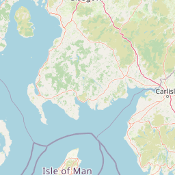
| Continue straight onto Bridgnorth Road (A442) | 20 km |
| Enter the traffic circle and take the 1st exit towards Shrewsbury | 6 m |
| Exit the traffic circle towards Shrewsbury | 2 km |
| Enter the traffic circle and take the 2nd exit onto Bridgnorth Bypass (A458) | 35 m |
| Exit the traffic circle onto Bridgnorth Bypass (A458) | 10 km |
| Continue slightly left onto Victoria Road (A458) | 400 m |
| Continue onto Shrewsbury Road (A458) | 5.5 km |
| Turn left onto Shrewsbury Road (A458) | 7 km |
| Continue straight onto A458 | 3.5 km |
| Take the ramp on the left onto A458 | 400 m |
| Merge right onto A5 | 2 km |
| Enter Bayston Hill Roundabout and take the 2nd exit towards North Wales | 100 m |
| Exit the traffic circle towards North Wales | 3 km |
| Enter the traffic circle and take the 2nd exit onto A5 | 70 m |
| Exit the traffic circle onto A5 | 1.5 km |
| Enter the traffic circle and take the 2nd exit onto A5 | 60 m |
| Exit the traffic circle onto A5 | 1.5 km |
| Enter the traffic circle and take the 2nd exit onto A5 | 40 m |
| Exit the traffic circle onto A5 | 7 km |
| Enter Felton Butler Roundabout and take the 2nd exit onto A5 | 60 m |
| Exit the traffic circle onto A5 | 4.5 km |
| Enter Wolfshead Roundabout and take the 2nd exit onto A5 | 45 m |
| Exit the traffic circle onto A5 | 10 km |
| Enter Mile End Roundabout and take the 2nd exit onto A5 | 60 m |
| Exit the traffic circle onto A5 | 2 km |
| Enter Whittington Roundabout and take the 2nd exit onto A5 | 40 m |
| Exit the traffic circle onto A5 | 1.5 km |
| Enter Five Crosses and take the 2nd exit onto A5 | 40 m |
| Exit the traffic circle onto A5 | 4 km |
| Enter Gledrid Roundabout and take the 3rd exit onto A5 | 80 m |
| Exit the traffic circle onto A5 | 3.5 km |
| Enter Halton Roundabout and take the 2nd exit onto A483 | 60 m |
| Exit the traffic circle onto A483 | 25 km |
| Enter Posthouse Roundabout and take the 1st exit towards A55: Conwy | 15 m |
| Exit the traffic circle towards A55: Conwy | 550 m |
| Merge right onto North Wales Expressway (A55) | 3 km |
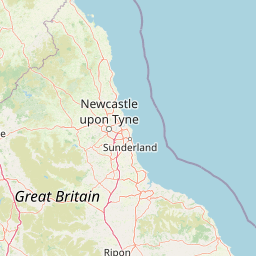
| Continue onto Gwibffordd Gogledd Cymru / North Wales Expressway (A55) | 70 km |
| Enter Puffin Roundabout and take the 2nd exit onto Gwibffordd Gogledd Cymru / North Wales Expressway (A55) | 40 m |
| Exit the traffic circle onto Gwibffordd Gogledd Cymru / North Wales Expressway (A55) | 4.5 km |
| Enter Llanfairfechan Roundabout and take the 2nd exit onto Gwibffordd Gogledd Cymru / North Wales Expressway (A55) | 40 m |
| Exit the traffic circle onto Gwibffordd Gogledd Cymru / North Wales Expressway (A55) | 50 km |
| Enter Kingsland Roundabout and take the 3rd exit onto Victoria Road (A55) | 80 m |
| Exit the traffic circle onto Victoria Road (A55) | 200 m |
| Turn right onto London Road (A55) | 150 m |
| Turn left onto Llanfawr Road (A55) | 100 m |
| Enter the traffic circle and take the 1st exit towards Ferry | 25 m |
| Exit the traffic circle towards Ferry | 40 m |
| Make a slight left | 1 km |
| Keep right at the fork | 500 m |
| Turn right | 200 m |
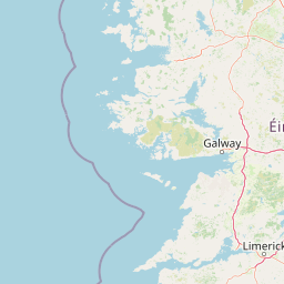
| Take the ferry Dublin - Holyhead | 100 km |
| Continue straight | 200 m |
| Make a slight left | 20 m |
| Keep right at the fork | 250 m |
| Turn left onto Tolka Quay Road | 300 m |
| Enter the traffic circle and take the 2nd exit onto Tolka Quay Road | 25 m |
| Exit the traffic circle onto Tolka Quay Road | 800 m |
| Enter the traffic circle and take the 1st exit onto Tolka Quay Road | 15 m |
| Exit the traffic circle onto Tolka Quay Road | 200 m |
| Turn right | 200 m |
| Continue left onto Promenade Road | 500 m |
| Take the ramp on the right towards M50 | 200 m |
| Merge right onto Dublin Tunnel (M50) | 60 m |
| Keep right onto Dublin Tunnel (M50) | 5 km |
| Continue onto Airport Motorway (M50) | 1.5 km |
| Keep right onto Airport Motorway (M1) | 2 km |
| Keep right onto Cloghran Lissenhall Motorway (M1) | 7 km |
| Continue onto Lissenhall Balbriggan Motorway (M1) | 9 km |
| Continue onto Balbriggan Bypass (M1) | 9 km |
| Continue onto Drogheda Bypass (M1) | 20 km |
| Continue onto Dunleer Bypass (M1) | 6 km |
| Continue onto Dunleer Dundalk Motorway (M1) | 15 km |
| Continue onto Dundalk Western Bypass (M1) | 10 km |
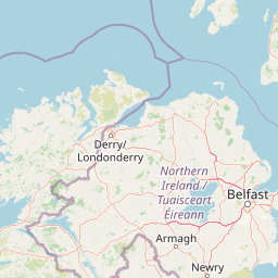
| Continue onto Newry Dundalk Link Road (N1) | 9 km |
| Continue onto Dublin Road (A1) | 15 km |
| Continue onto Belfast Road (A1) | 35 km |
| Enter Hillsborough Roundabout and take the 1st exit onto Hillsborough Road (A1) | 45 m |
| Exit the traffic circle onto Hillsborough Road (A1) | 2 km |
| Enter the traffic circle and take the 2nd exit onto Hillsborough Road (A1) | 55 m |
| Exit the traffic circle onto Hillsborough Road (A1) | 400 m |
| Enter the traffic circle and take the 1st exit towards M1: Belfast | 60 m |
| Exit the traffic circle towards M1: Belfast | 700 m |
| Merge right onto M1 | 15 km |
| Continue onto Westlink (A12) | 800 m |
| Take the ramp on the left | 300 m |
| Keep right at the fork | 45 m |
| Turn right onto Grosvenor Road (B38) | 550 m |
| Turn left onto Fisherwick Place (A1) | 100 m |
| Keep right onto College Square East (A1) | 45 m |
| Turn right onto Wellington Place (A1) | 250 m |
| Continue onto Donegall Square North (A1) | 100 m |
| Turn right to stay on Donegall Square East (A1) | 150 m |
| Turn right to stay on Donegall Square South (A20) | 60 m |
| You have arrived at your destination, on the right | 0 m |


 Accedi con Google