


Distance Calculator

Distance from Nice to Clermont-Ferrand
The shortest distance (air line) between Nice and Clermont-Ferrand is 250.56mi (403.23 km)
The shortest route between Nice and Clermont-Ferrand is 392.16 mi (631.11 km) according to the route planner. The driving time is approx. 6 h 50 m
How far is it between Nice and Clermont-Ferrand.
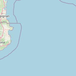
Nice is located in Alpes-Maritimes, Francecountry within 43° 42' 12.24" N 7° 15' 58.68" E (43.7034, 7.2663) coordinates. The local time in Nice is 15:39 (21.03.2025)
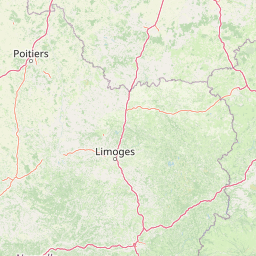
Clermont-Ferrand is located in Puy-de-Dome, Francecountry within 45° 46' 59.16" N 3° 4' 56.64" E (45.7831, 3.0824) coordinates. The local time in Clermont-Ferrand is 15:39 (21.03.2025)
The calculated flying distance from Nice to Clermont-Ferrand is 250.56miles which is equal to 403.23 km.
If you want to go by car, the driving driving distance between Nice and Clermont-Ferrand is 392.16 miles (631.11 km). If you ride your car with an average speef of 112 kilometers/hour (70 miles/h), travel time will be 5 hours 38 minutes.Please check the avg.speed travel time on the right for various options
Estimated Travel Time Between Nice and Clermont-Ferrand
| Average speed | Travel Time |
|---|---|
| 30 mph (48 km/h) | 13 hours 4 minutes |
| 40 mph (64 km/h) | 9 hours 48 minutes |
| 50 mph (80 km/h) | 7 hours 51 minutes |
| 60 mph (67 km/h) | 6 hours 32 minutes |
| 70 mph (112 km/h) | 5 hours 36 minutes |
| 75 mph (120 km/h) | 5 hours 14 minutes |
Related Distances from Nice
| Cities | Distance |
|---|---|
| Nice to Brest | 649.14 mi (1,044.68 km) |
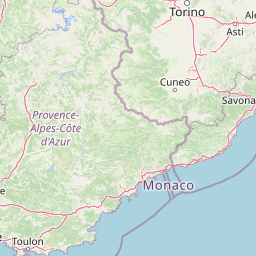
| Nice to Toulon | 78.02 mi (125.55 km) |
| Nice to Aix-en-Provence | 91.90 mi (147.90 km) |
| Nice to Marseille | 99.11 mi (159.50 km) |
| Nice to Grenoble | 126.84 mi (204.13 km) |
| Nice to Nimes | 145.25 mi (233.75 km) |
| Nice to Montpellier | 169.52 mi (272.81 km) |
| Nice to Villeurbanne | 184.48 mi (296.88 km) |
| Nice to Saint-Etienne | 185.31 mi (298.23 km) |
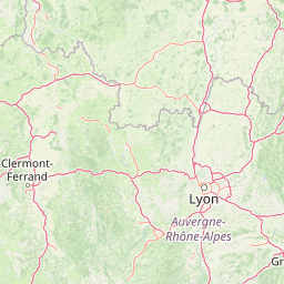
| Nice to Lyon | 185.39 mi (298.35 km) |
| Nice to Clermont-Ferrand | 250.56 mi (403.23 km) |
| Nice to Dijon | 272.35 mi (438.31 km) |
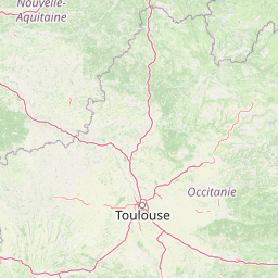
| Nice to Toulouse | 291.08 mi (468.45 km) |
| Nice to Strasbourg | 337.95 mi (543.87 km) |
| Nice to Bordeaux | 395.88 mi (637.10 km) |
| Nice to Tours | 407.54 mi (655.87 km) |
| Nice to Reims | 413.64 mi (665.69 km) |
| Nice to Paris | 426.22 mi (685.94 km) |
| Nice to Boulogne-Billancourt | 427.96 mi (688.73 km) |
| Nice to Le Mans | 451.47 mi (726.57 km) |
| Nice to Angers | 458.82 mi (738.40 km) |
| Nice to Nantes | 491.14 mi (790.41 km) |
| Nice to Lille | 517.44 mi (832.74 km) |
| Nice to Le Havre | 524.50 mi (844.10 km) |
| Nice to Rennes | 526.57 mi (847.43 km) |
Clermont-Ferrand, Puy-de-Dome, France
 Accedi con Google