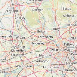
Distance Calculator

M62, A1(M)

179.4 km, 2 h 11 min

Head southeast on High Street55 m
Turn right onto Water Street (A57)150 m
Turn right onto Covent Garden150 m
Turn right onto Chapel Street (A5046)150 m
Continue onto Tithebarn Street (A5046)450 m
Continue onto Great Crosshall Street (A5046)300 m
Turn right onto Fontenoy Street100 m
Make a slight left to stay on Fontenoy Street55 m
Merge right onto Byrom Street (A59)70 m
Keep right at the fork55 m
Turn right onto Hunter Street (A5047)450 m
Make a slight right onto St Anne Street (B5186)70 m
Continue onto Norton Street (B5186)200 m
Turn left onto London Road (A5047)200 m
Continue onto Pembroke Place (A5047)450 m
Continue onto West Derby Street (A5047)250 m
Continue onto Mount Vernon Road (A5047)200 m
Continue onto North View (A5047)100 m
Continue onto Edge Lane (A5047)2.5 km
Continue onto Edge Lane Drive (A5080)1 km
Continue onto Bowring Park Road (A5080)400 m
Continue onto M6235 km
Take the ramp on the left towards M60: Leeds550 m
Continue towards M6010 km
Continue onto M6245 km
Keep right onto M627 km
Keep right onto M629 km
Take the ramp on the left1.5 km
Merge right onto M11.5 km
Keep left towards M145 km
Take the ramp on the left towards A6055: Boroughbridge500 m
Enter the traffic circle and take the 3rd exit onto A6055100 m
Exit the traffic circle onto A6055150 m
Enter the traffic circle and take the 1st exit onto A16810 m
Exit the traffic circle onto A1681 km
Enter the traffic circle and take the 2nd exit onto A16845 m
Exit the traffic circle onto A1682.5 km
Enter the traffic circle and take the 1st exit onto B62656 m
Exit the traffic circle onto B62657 km
Enter the traffic circle and take the 2nd exit onto Boroughbridge Road (B6265)40 m
Exit the traffic circle onto Boroughbridge Road (B6265)250 m
Continue onto Bondgate Green (B6265)550 m
Enter the traffic circle and take the 2nd exit towards Pateley Bridge25 m
Exit the traffic circle towards Pateley Bridge100 m
Continue slightly left onto Water Skellgate (B6265)150 m
Turn right towards City Centre150 m
Turn right onto Market Place West250 m
You have arrived at your destination, on the left0 m

M6, A59

159.6 km, 2 h 13 min

Head southeast on High Street55 m
Turn right onto Water Street (A57)150 m
Turn right onto Covent Garden150 m
Turn right onto Chapel Street (A5046)150 m
Continue onto Tithebarn Street (A5046)250 m
Turn left onto Pall Mall (B5182)400 m
Turn left onto Leeds Street (A5053)80 m
Keep right onto Leeds Street (A5053)100 m
Turn right onto Great Howard Street (A565)1.5 km
Continue onto Derby Road (A565)2.5 km
Continue onto Rimrose Road (A565)1 km
Continue onto Crosby Road South (A565)450 m
Take the ramp on the left250 m
Keep right at the fork80 m
Enter the traffic circle and take the 2nd exit onto Princess Way (A5036)90 m
Exit the traffic circle onto Princess Way (A5036)800 m
Enter the traffic circle and take the 2nd exit onto Church Road (A5036)80 m
Exit the traffic circle onto Church Road (A5036)2 km
Continue onto Dunnings Bridge Road (A5036)2.5 km
Continue onto Switch Island (A5036)250 m
Continue onto Dunnings Bridge Road (A5036)200 m
Keep right towards Skelmersdale15 km
Take exit 5 on the left towards a577: Pimbo350 m
Keep right onto M583.5 km
Enter Orrell Interchange and take the 2nd exit onto M6200 m
Exit the traffic circle onto M625 km
Take the ramp on the left400 m
Keep right at the fork150 m
Enter Samlesbury Interchange and take the 4th exit onto Preston New Road (A59)450 m
Exit the traffic circle onto Preston New Road (A59)2 km
Keep right onto Preston New Road (A59)300 m
Enter the traffic circle and take the 1st exit onto Whalley Road (A59)4 m
Exit the traffic circle onto Whalley Road (A59)2 km
Continue onto Myerscough Smithy Road (A59)2 km
Enter the traffic circle and take the 1st exit onto A5950 m
Exit the traffic circle onto A598 km
Enter Langho Roundabout and take the 1st exit onto Whalley Bypass (A59)150 m
Exit the traffic circle onto Whalley Bypass (A59)4 km
Enter Whalley Roundabout and take the 1st exit onto A5945 m
Exit the traffic circle onto A59900 m
Enter the traffic circle and take the 2nd exit onto A5940 m
Exit the traffic circle onto A59700 m
Enter the traffic circle and take the 2nd exit onto A5930 m
Exit the traffic circle onto A592 km
Enter the traffic circle and take the 2nd exit onto A5960 m
Exit the traffic circle onto A5925 km
Enter the traffic circle and take the 1st exit onto A5920 m
Exit the traffic circle onto A595 km
Enter Gargrave Road Roundabout and take the 2nd exit onto Skipton Bypass (A65)55 m
Exit the traffic circle onto Skipton Bypass (A65)1 km
Enter the traffic circle and take the 2nd exit onto Skipton Bypass (A65)80 m
Exit the traffic circle onto Skipton Bypass (A65)3 km
Enter the traffic circle and take the 1st exit onto Harrogate Road (A59)30 m
Exit the traffic circle onto Harrogate Road (A59)2 km
Continue onto Long Causeway (A59)4.5 km
Enter Bolton Bridge Roundabout and take the 2nd exit onto A5930 m
Exit the traffic circle onto A5915 km
Turn left onto Hardgroves Hill (B6451)3 km
Continue onto Darley Carr (B6451)1 km
Continue onto Mill Hurst (B6451)3 km
Turn left onto B61658 m
Turn right onto Hartwith Bank1.5 km
Continue onto Brimham Rocks Road2.5 km
Continue onto Brimham Moor Road1 km
Turn right onto B626510 km
Turn right onto Mallorie Park Drive (B6265)700 m
Continue onto Skellbank (B6265)350 m
Turn left towards City Centre150 m
Turn right onto Market Place West250 m
You have arrived at your destination, on the left0 m
From
    To

      Distance: 78.36 mi (126.10 km)

      Driving route: 111.50 mi (179.45 km).

      Driving time: 2h 11 min

      Distance from Ripon to Liverpool

      The shortest distance (air line) between Ripon and Liverpool is 78.36mi (126.10 km)

      The shortest route between Ripon and Liverpool is 111.50 mi (179.45 km) according to the route planner. The driving time is approx. 2 h 11 m

      How far is it between Ripon and Liverpool.

      Ripon is located in North Yorkshire CC, United Kingdomcountry within 54° 8' 16.8" N -2° 28' 33.6" W (54.1380, -1.5240) coordinates. The local time in Ripon is 21:17 (12.01.2025)

      Liverpool is located in Liverpool, United Kingdomcountry within 53° 24' 27" N -3° 0' 29.16" W (53.4075, -2.9919) coordinates. The local time in Liverpool is 21:17 (12.01.2025)

      The calculated flying distance from Ripon to Liverpool is 78.36miles which is equal to 126.10 km.

      If you want to go by car, the driving driving distance between Ripon and Liverpool is 111.50 miles (179.45 km). If you ride your car with an average speef of 112 kilometers/hour (70 miles/h), travel time will be 1 hours 36 minutes.Please check the avg.speed travel time on the right for various options

      Estimated Travel Time Between Ripon and Liverpool

      Average speedTravel Time
      30 mph (48 km/h)3 hours 43 minutes
      40 mph (64 km/h)2 hours 47 minutes
      50 mph (80 km/h)2 hours 14 minutes
      60 mph (67 km/h)1 hours 52 minutes
      70 mph (112 km/h)1 hours 36 minutes
      75 mph (120 km/h)1 hours 29 minutes

      Ripon, North Yorkshire CC, United Kingdom

      Related Distances from Ripon

      CitiesDistance
      Ripon to Leeds23.36 mi (37.59 km)
      Ripon to Bradford25.09 mi (40.39 km)
      Ripon to Sheffield52.36 mi (84.27 km)
      Ripon to Bolton53.45 mi (86.02 km)
      Ripon to Manchester54.19 mi (87.21 km)
      Ripon to Kingston upon Hull55.57 mi (89.43 km)
      Ripon to Stockport56.52 mi (90.95 km)
      Ripon to Newcastle58.28 mi (93.79 km)
      Ripon to Liverpool78.36 mi (126.10 km)
      Ripon to Stoke-on-Trent83.15 mi (133.82 km)
      Ripon to Nottingham83.28 mi (134.03 km)
      Ripon to Leicester105.14 mi (169.20 km)
      Ripon to Birmingham115.62 mi (186.07 km)
      Ripon to Coventry119.53 mi (192.36 km)
      Ripon to Edinburgh141.68 mi (228.01 km)
      Ripon to Glasgow160.74 mi (258.69 km)
      Ripon to Belfast180.13 mi (289.89 km)
      Ripon to Ipswich181.59 mi (292.24 km)
      Ripon to Reading186.85 mi (300.71 km)
      Ripon to Bristol190.81 mi (307.08 km)
      Ripon to London190.88 mi (307.20 km)
      Ripon to Caerdydd196.11 mi (315.60 km)
      Ripon to Southampton223.61 mi (359.86 km)
      Ripon to Portsmouth230.96 mi (371.70 km)
      Ripon to Worthing234.68 mi (377.68 km)

      Liverpool, Liverpool, United Kingdom

      Related Distances to Liverpool

      CitiesDistance
      Bolton to Liverpool25.96 mi (41.79 km)
      Manchester to Liverpool31.12 mi (50.09 km)
      Stockport to Liverpool34.70 mi (55.84 km)
      Stoke-on-Trent to Liverpool43.73 mi (70.38 km)
      Bradford to Liverpool57.69 mi (92.84 km)
      Sheffield to Liverpool62.72 mi (100.93 km)
      Leeds to Liverpool65.06 mi (104.70 km)
      Birmingham to Liverpool78.51 mi (126.35 km)
      Nottingham to Liverpool82.47 mi (132.72 km)
      Coventry to Liverpool92.61 mi (149.05 km)
      Leicester to Liverpool93.96 mi (151.21 km)
      Kingston upon Hull to Liverpool111.55 mi (179.52 km)
      Newcastle to Liverpool122.16 mi (196.60 km)
      Sunderland to Liverpool122.33 mi (196.88 km)
      Caerdydd to Liverpool133.29 mi (214.51 km)
      Bristol to Liverpool136.02 mi (218.90 km)
      Belfast to Liverpool144.84 mi (233.10 km)
      Reading to Liverpool159.51 mi (256.70 km)
      Edinburgh to Liverpool176.07 mi (283.36 km)
      Glasgow to Liverpool176.83 mi (284.58 km)
      London to Liverpool178.25 mi (286.86 km)
      Southampton to Liverpool185.69 mi (298.84 km)
      Ipswich to Liverpool196.90 mi (316.88 km)
      Portsmouth to Liverpool197.08 mi (317.17 km)
      Worthing to Liverpool210.82 mi (339.27 km)