Distance Calculator

A 96, A 8

412.8 km, 4 h 24 min

Head northeast25 m
Turn left onto Kehlerstraße350 m
Continue onto Kreuzgasse150 m
Turn right onto Stadtstraße (L190)550 m
Continue onto Vorarlbergerstraße (L190)2.5 km
Enter Vorarlbergerstraße and take the 3rd exit towards A14: Innsbruck80 m
Exit the traffic circle towards A14: Innsbruck500 m
Keep right towards A 14: Deutschland550 m
Merge left onto Rheintal/Walgau Autobahn (A14)15 km
Continue onto A 96150 km
Take the ramp towards Messe / ICM550 m
Merge left onto Garmischer Straße (B 2R)2 km
Continue onto Heckenstallertunnel (B 2R)600 m
Continue onto Heckenstallerstraße (B 2R)400 m
Continue onto Brudermühlstraße (B 2R)400 m
Continue onto Brudermühltunnel (B 2R)800 m
Continue onto Brudermühlstraße (B 2R)350 m
Continue onto Brudermühlbrücke (B 2R)150 m
Continue onto Candidstraße (B 2R)900 m
Continue onto Candidtunnel (B 2R)250 m
Continue onto Tegernseer Landstraße (B 2R)2 km
Continue towards Salzburg10 km
Take the ramp on the left towards A 8: Salzburg1.5 km
Continue towards A 8: Innsbruck550 m
Merge left towards Salzburg100 km
Continue onto West Autobahn (A1)9 km
Continue onto Tunnel Liefering (A1)500 m
Continue onto West Autobahn (A1)70 km
Take exit 224 towards B145: Regau700 m
Turn right onto Salzkammergut Straße (B145)4 km
Turn right towards Preising2 km
Continue onto Gmundner Straße (L1265)700 m
Continue onto Puchheimer Straße (L1265)800 m
Continue onto Bahnhofstraße (L1265)250 m
Turn left onto Europaplatz (L1265)55 m
Turn left towards B1: Wolfsegg250 m
Turn right onto Salzburger Straße1 km
Turn left onto Passauer Straße200 m
Turn left onto Wiesenstraße100 m
You have arrived at your destination, on the left0 m

A 8, A 94

466.4 km, 4 h 53 min

Head northeast25 m
Turn left onto Kehlerstraße350 m
Continue onto Kreuzgasse150 m
Turn right onto Stadtstraße (L190)550 m
Continue onto Vorarlbergerstraße (L190)2.5 km
Enter Vorarlbergerstraße and take the 3rd exit towards A14: Innsbruck80 m
Exit the traffic circle towards A14: Innsbruck500 m
Keep right towards A 14: Deutschland550 m
Merge left onto Rheintal/Walgau Autobahn (A14)15 km
Continue onto A 9660 km
Take the ramp on the left towards A 7: Würzburg55 km
Take the ramp towards A 8: Stuttgart450 m
Keep right towards A 8: München100 km
Keep right towards A 99: Salzburg30 km
Take exit 17 towards A 94: Passau250 m
Keep left towards A 94: Passau350 m
Keep right towards A 94: Passau550 m
Keep left towards A 94: Passau500 m
Merge left towards A 94: Passau90 km
Continue onto B 1215 km
Continue onto Neue Innbrückenstraße (B148)1.5 km
Enter the traffic circle and take the 2nd exit towards B148: Salzburg55 m
Exit the traffic circle towards B148: Salzburg900 m
Enter the traffic circle and take the 2nd exit towards B148: Braunau70 m
Exit the traffic circle towards B148: Braunau15 km
Enter the traffic circle and take the 2nd exit towards B148: Schärding55 m
Exit the traffic circle towards B148: Schärding4.5 km
Enter the traffic circle and take the 2nd exit towards B148: Schärding70 m
Exit the traffic circle towards B148: Schärding1.5 km
Enter the traffic circle and take the 2nd exit towards B148: Schärding70 m
Exit the traffic circle towards B148: Schärding15 km
Take the ramp on the right towards A8: Linz450 m
Merge left towards Ried im Innkreis20 km
Take the ramp towards B141: Haag am Hausruck350 m
Turn left onto Rieder Straße (B141)250 m
Enter the traffic circle and take the 3rd exit onto Gaspoltshofener Straße (L520)90 m
Exit the traffic circle onto Gaspoltshofener Straße (L520)10 km
Enter the traffic circle and take the 2nd exit towards Lambach45 m
Exit the traffic circle towards Lambach1.5 km
Turn right to stay on Gallspacher Straße (B135)2 km
Continue onto Hauptstraße (B135)6 km
Continue onto Gallspacher Straße (B135)1.5 km
Turn left onto B135200 m
Turn right to stay on Bahnhofstraße500 m
Continue onto Huberstraße200 m
Turn left to stay on Huberstraße25 m
Turn right onto Salzburger Straße (B135)500 m
Enter the traffic circle and take the 1st exit towards B1: Vöcklabruck45 m
Exit the traffic circle towards B1: Vöcklabruck4.5 km
Turn left onto Badgasse90 m
Turn right onto Waldstraße200 m
Turn right250 m
Continue onto Bahnhofstraße200 m
Continue onto Passauer Straße200 m
Turn left onto Wiesenstraße100 m
You have arrived at your destination, on the left0 m
From
    To

      Distance: 188.97 mi (304.12 km)

      Driving route: 256.48 mi (412.77 km).

      Driving time: 4h 23 min

      Distance from Attnang-Puchheim to Dornbirn

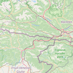
      The shortest distance (air line) between Attnang-Puchheim and Dornbirn is 188.97mi (304.12 km)

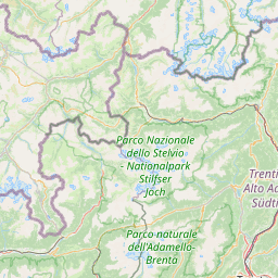
      The shortest route between Attnang-Puchheim and Dornbirn is 256.48 mi (412.77 km) according to the route planner. The driving time is approx. 4 h 23 m

      How far is it between Attnang-Puchheim and Dornbirn.

      Attnang-Puchheim is located in Traunviertel, Austriacountry within 48° 1' 0.12" N 13° 43' 0.12" E (48.0167, 13.7167) coordinates. The local time in Attnang-Puchheim is 00:26 (15.03.2025)

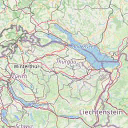
      Dornbirn is located in Rheintal-Bodenseegebiet, Austriacountry within 47° 25' 0.12" N 9° 45' 0" E (47.4167, 9.7500) coordinates. The local time in Dornbirn is 00:26 (15.03.2025)

      The calculated flying distance from Attnang-Puchheim to Dornbirn is 188.97miles which is equal to 304.12 km.

      If you want to go by car, the driving driving distance between Attnang-Puchheim and Dornbirn is 256.48 miles (412.77 km). If you ride your car with an average speef of 112 kilometers/hour (70 miles/h), travel time will be 3 hours 41 minutes.Please check the avg.speed travel time on the right for various options

      Estimated Travel Time Between Attnang-Puchheim and Dornbirn

      Average speedTravel Time
      30 mph (48 km/h)8 hours 33 minutes
      40 mph (64 km/h)6 hours 25 minutes
      50 mph (80 km/h)5 hours 8 minutes
      60 mph (67 km/h)4 hours 16 minutes
      70 mph (112 km/h)3 hours 40 minutes
      75 mph (120 km/h)3 hours 25 minutes

      Attnang-Puchheim, Traunviertel, Austria

      Related Distances from Attnang-Puchheim

      CitiesEdite sus datos personales, tarjetas de crédito guardadas y preferencias de viaje
      Attnang-Puchheim to Wels16.63 mi (26.76 km)
      Attnang-Puchheim to Traun27.97 mi (45.02 km)
      Attnang-Puchheim to Leonding30.65 mi (49.33 km)
      Attnang-Puchheim to Steyr32.37 mi (52.09 km)
      Attnang-Puchheim to Linz32.99 mi (53.09 km)
      Attnang-Puchheim to Salzburg34.52 mi (55.56 km)
      Attnang-Puchheim to Amstetten53.55 mi (86.17 km)
      Attnang-Puchheim to Leoben77.75 mi (125.13 km)
      Attnang-Puchheim to Sankt Polten88.56 mi (142.53 km)
      Attnang-Puchheim to Krems an der Donau91.73 mi (147.63 km)
      Attnang-Puchheim to Wolfsberg96.69 mi (155.61 km)
      Attnang-Puchheim to Villach96.88 mi (155.92 km)
      Attnang-Puchheim to Klagenfurt100.51 mi (161.76 km)
      Attnang-Puchheim to Graz103.54 mi (166.63 km)
      Attnang-Puchheim to Hall in Tirol114.94 mi (184.98 km)
      Attnang-Puchheim to Baden116.37 mi (187.28 km)
      Attnang-Puchheim to Wiener Neustadt118.12 mi (190.09 km)
      Attnang-Puchheim to Modling118.62 mi (190.91 km)
      Attnang-Puchheim to Innsbruck119.88 mi (192.92 km)
      Attnang-Puchheim to Klosterneuburg121.46 mi (195.47 km)
      Attnang-Puchheim to Vienna123.22 mi (198.31 km)
      Attnang-Puchheim to Eisenstadt130.12 mi (209.41 km)
      Attnang-Puchheim to Bregenz187.61 mi (301.94 km)
      Attnang-Puchheim to Dornbirn188.97 mi (304.12 km)
      Attnang-Puchheim to Lustenau192.38 mi (309.61 km)

      Dornbirn, Rheintal-Bodenseegebiet, Austria

      Related Distances to Dornbirn

      CitiesEdite sus datos personales, tarjetas de crédito guardadas y preferencias de viaje
      Lustenau to Dornbirn3.76 mi (6.05 km)
      Bregenz to Dornbirn6.10 mi (9.82 km)
      Innsbruck to Dornbirn77.62 mi (124.91 km)
      Hall in Tirol to Dornbirn82.44 mi (132.67 km)
      Salzburg to Dornbirn155.74 mi (250.65 km)
      Villach to Dornbirn200.11 mi (322.04 km)
      Wels to Dornbirn204.43 mi (329.00 km)
      Traun to Dornbirn215.56 mi (346.91 km)
      Leonding to Dornbirn217.09 mi (349.37 km)
      Linz to Dornbirn219.04 mi (352.52 km)
      Steyr to Dornbirn221.01 mi (355.68 km)
      Klagenfurt to Dornbirn221.31 mi (356.17 km)
      Amstetten to Dornbirn242.45 mi (390.18 km)
      Wolfsberg to Dornbirn242.53 mi (390.32 km)
      Leoben to Dornbirn250.04 mi (402.40 km)
      Kapfenberg to Dornbirn258.88 mi (416.62 km)
      Graz to Dornbirn267.84 mi (431.04 km)
      Sankt Polten to Dornbirn277.49 mi (446.58 km)
      Krems an der Donau to Dornbirn280.24 mi (451.00 km)
      Wiener Neustadt to Dornbirn303.90 mi (489.09 km)
      Baden to Dornbirn304.12 mi (489.43 km)
      Modling to Dornbirn306.90 mi (493.90 km)
      Klosterneuburg to Dornbirn310.43 mi (499.58 km)
      Vienna to Dornbirn312.01 mi (502.13 km)
      Eisenstadt to Dornbirn316.37 mi (509.16 km)